Area Overview for NE4 9UU
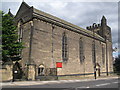
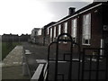
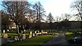
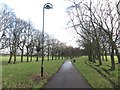
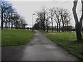
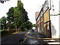
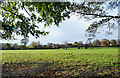
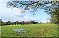
Photos of NE4 9UU


Area Information
NE4 9UU is a compact residential postcode in England, covering 6,663 square metres and home to 1,892 residents. Its high population density—283,954 people per square kilometre—suggests a tightly knit community, though the area’s small size means it is likely a single cluster of homes rather than a sprawling suburb. The postcode is notable for its proximity to key infrastructure, including rail and metro links, and its connection to Newcastle Airport, just 10 miles away. Daily life here is shaped by the mix of local amenities, from independent schools to retail outlets like Morrisons Fenham and Spar. The area’s appeal lies in its balance of accessibility and residential tranquility, with no major environmental constraints such as protected woodlands or AONBs. Residents benefit from a low flood risk and below-average crime rates, making it a practical choice for those prioritising safety and convenience. The high broadband score of 100 ensures seamless digital connectivity, supporting both remote work and leisure. While the area is small, its strategic location near transport hubs and schools positions it as a viable option for families and professionals alike.
- Area Type
- Postcode
- Area Size
- 6663 m²
- Population
- 1892
- Population Density
- 4990 people/km²
NE4 9UU is predominantly an owner-occupied area, with 81% of homes owned by residents rather than rented. The accommodation type is primarily houses, which suggests a focus on family-friendly properties rather than apartments or flats. This housing stock is typical of smaller, established communities where long-term residency is common. The high home ownership rate may indicate limited rental availability, making the area more attractive to buyers seeking stability rather than investment. Given the postcode’s compact size, the housing market is likely limited to a few dozen properties, with prices influenced by proximity to schools and transport. Buyers should consider the area’s small footprint, which may restrict access to larger estates or developments. The focus on houses also means that properties are likely to be semi-detached or terraced, offering a balance of privacy and community living.
House Prices in NE4 9UU
Showing 20 properties
| Address | Type | Beds | Baths | Last Sale Price | Last Sale Date | |
|---|---|---|---|---|---|---|
| 31 Fenham Hall Drive, Newcastle Upon Tyne, NE4 9UU | Semi-detached | 3 | 1 | £242,500 | Oct 2024 | |
| 37 Fenham Hall Drive, Newcastle Upon Tyne, NE4 9UU | house | - | - | £250,000 | Sep 2022 | |
| 48 Fenham Hall Drive, Newcastle Upon Tyne, NE4 9UU | house | - | - | £245,000 | Oct 2021 | |
| 46 Fenham Hall Drive, Newcastle Upon Tyne, NE4 9UU | house | 4 | - | £258,000 | Jul 2019 | |
| 41 Fenham Hall Drive, Newcastle Upon Tyne, NE4 9UU | house | 3 | - | £175,000 | Oct 2013 | |
| 43 Fenham Hall Drive, Newcastle Upon Tyne, NE4 9UU | house | 3 | - | £147,000 | May 2012 | |
| 35 Fenham Hall Drive, Newcastle Upon Tyne, NE4 9UU | Semi-detached | 3 | 1 | £175,000 | Sep 2009 | |
| 25 Fenham Hall Drive, Newcastle Upon Tyne, NE4 9UU | Terraced | - | - | £170,000 | Apr 2006 | |
| 32 Fenham Hall Drive, Newcastle Upon Tyne, NE4 9UU | Maisonette | - | - | £95,000 | Sep 2001 | |
| 33 Fenham Hall Drive, Newcastle Upon Tyne, NE4 9UU | house | - | - | £40,000 | Aug 2001 |
Energy Efficiency in NE4 9UU
Living in NE4 9UU offers access to a range of amenities within practical reach. Retail options include Morrisons Fenham, Spar, and Co-op Cedar, providing everyday shopping needs. The area’s transport links—five metro stops, five rail stations, and a bus stop—connect residents to Newcastle’s cultural and commercial centres. For leisure, the proximity to Newcastle Airport and nearby parks (though not named in the data) may offer recreational opportunities. The presence of independent schools and sixth-form centres caters to families, while the low crime rate and flood risk contribute to a sense of security. The compact nature of the area means amenities are concentrated, reducing the need for long commutes. This combination of retail, transport, and educational facilities supports a convenient, community-oriented lifestyle.
Amenities
Schools
The area is served by three educational institutions, all affiliated with Dame Allan’s Schools. These include Dame Allan’s Schools, an independent institution, and Dame Allan’s Girls’ School, also independent, alongside Dame Allan’s Schools Centre, which offers sixth-form education. The presence of both independent and sixth-form facilities suggests a focus on high-quality education, though no Ofsted ratings are provided. For families, this mix offers options from primary to secondary education, with the independent schools likely offering specialist curricula or extracurricular programmes. The proximity of these schools to NE4 9UU makes it an appealing choice for parents prioritising educational standards. However, the absence of state schools or primary institutions in the data means the area may rely on nearby schools outside the postcode for younger children.
| Rank | School | Type | Entry gender | Ages |
|---|
Explore more schools in this area
Go to Schools tabDemographics
The population of NE4 9UU skews towards adults aged 30–64, with a median age of 47. This suggests a community of established professionals and families, rather than a student or retirement demographic. Home ownership is high at 81%, indicating a stable, long-term resident base. The predominant accommodation type is houses, which aligns with the area’s low population density and suggests a mix of semi-detached or terraced properties. The predominant ethnic group is White, though no specific data on diversity or deprivation is provided. The absence of detailed diversity metrics means the area’s social composition remains largely uncharacterised in the data. The age profile implies a mature, settled population, which may influence local services and amenities. With no indication of high deprivation levels, the area appears to support a quality of life aligned with its infrastructure and safety profile.
Household Size
Accommodation Type
Tenure
Ethnic Group
Religion
Household Composition
Age
Household Deprivation
NS-SEC
Explore more demographic insights in this area
Go to Demographics tabPlanning
Planning Constraints
- Flood RiskPremium
- Ramsar Wetland SitesPremium
- Area of Outstanding Natural BeautyPremium
- Protected Nature ReservePremium
- Protected WoodlandPremium