Area Overview for NE4 9UP
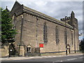
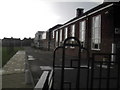
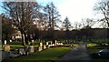
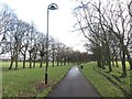
Photos of NE4 9UP


Area Information
NE4 9UP is a compact residential postcode in England, covering just 1.2 hectares and home to 1,460 people. Its high population density of 118,325 people per square kilometre reflects a tightly knit community, where daily life revolves around close proximity to amenities and transport links. The area is characterised by a mature demographic, with a median age of 47 and a majority of residents aged 30–64. This suggests a stable, established neighbourhood with a focus on long-term living. The postcode’s small size means it is likely a single residential cluster, possibly centred around local landmarks or green spaces. With no significant environmental constraints like protected woodlands or AONB areas, the area offers a straightforward living experience without complex planning restrictions. Its proximity to retail, transport, and leisure options within walking distance makes it practical for those prioritising convenience over expansive surroundings. For buyers, NE4 9UP represents a blend of compact living and accessibility, ideal for those seeking a well-connected, low-maintenance home.
- Area Type
- Postcode
- Area Size
- 1.2 hectares
- Population
- 1460
- Population Density
- 2938 people/km²
The property market in NE4 9UP is dominated by owner-occupied homes, with 83% of residents living in properties they own. This high rate of home ownership suggests a stable, long-term market with limited rental activity. The accommodation type is primarily houses, indicating a preference for detached or semi-detached properties over flats or terraced homes. Given the area’s small size—just 1.2 hectares—housing stock is likely limited, with properties concentrated in a single cluster. For buyers, this means competition may be fierce, but the compact nature of the area could also mean a strong sense of community and well-maintained properties. The absence of protected environmental areas or planning constraints may make it easier to purchase or renovate homes. However, the high population density and small footprint mean there is little scope for new developments, which could impact future availability or price trends.
House Prices in NE4 9UP
Showing 42 properties
| Address | Type | Beds | Baths | Last Sale Price | Last Sale Date | |
|---|---|---|---|---|---|---|
| 7 Friarside Road, Newcastle Upon Tyne, NE4 9UP | Semi-detached | 3 | 1 | £255,000 | Jan 2024 | |
| 26 Friarside Road, Newcastle Upon Tyne, NE4 9UP | Semi-detached | 4 | 1 | £305,000 | Oct 2023 | |
| 33 Friarside Road, Newcastle Upon Tyne, NE4 9UP | Semi-detached | 3 | 1 | £185,000 | May 2023 | |
| 15 Friarside Road, Newcastle Upon Tyne, NE4 9UP | house | - | - | £240,000 | Sep 2021 | |
| 5 Friarside Road, Newcastle Upon Tyne, NE4 9UP | Terraced | 3 | 1 | £320,000 | Jun 2021 | |
| 31 Friarside Road, Newcastle Upon Tyne, NE4 9UP | Semi-detached | 4 | 1 | £217,000 | Jan 2021 | |
| 14 Friarside Road, Newcastle Upon Tyne, NE4 9UP | Semi-detached | 5 | 1 | £150,000 | Feb 2018 | |
| 43 Friarside Road, Newcastle Upon Tyne, NE4 9UP | Semi-detached | 3 | 1 | £155,000 | May 2017 | |
| 27 Friarside Road, Newcastle Upon Tyne, NE4 9UP | Semi-detached | 5 | - | £200,000 | Apr 2015 | |
| 32 Friarside Road, Newcastle Upon Tyne, NE4 9UP | Semi-detached | 3 | - | £130,000 | Aug 2014 |
Energy Efficiency in NE4 9UP
Living in NE4 9UP offers a mix of practical convenience and local amenities. Within practical reach are five retail options, including Morrisons Fenham, Spar, and Aldi Fenham, providing essential shopping and grocery needs. The area is well-served by transport, with five Metro stations, five rail stations, and a bus stop, ensuring easy access to nearby towns and cities. Newcastle Airport is also nearby, making travel straightforward. While specific parks or leisure facilities are not listed in the data, the absence of environmental constraints like protected woodlands or AONB areas suggests open space may be limited. The presence of multiple transport links and retail options fosters a self-contained lifestyle, where daily errands and commuting are efficiently managed. This makes NE4 9UP appealing to those who prioritise accessibility over expansive green spaces.
Amenities
Schools
| Rank | School | Type | Entry gender | Ages |
|---|
Explore more schools in this area
Go to Schools tabDemographics
The community in NE4 9UP is predominantly composed of adults aged 30–64, with a median age of 47. This indicates a mature population, likely with established careers and families. Home ownership is high at 83%, suggesting a stable housing market where most residents are long-term homeowners. The area is primarily composed of houses, reflecting a preference for single-family dwellings over flats or apartments. The predominant ethnic group is White, aligning with broader trends in the region. The high population density of 118,325 people per square kilometre means the area is intensely populated, which can influence local services and infrastructure. While no specific deprivation data is provided, the high home ownership and low crime risk (69/100) imply a relatively secure and self-sufficient community. However, the compact size and density may also mean limited space for expansion or new developments, which could affect future property values or availability.
Household Size
Accommodation Type
Tenure
Ethnic Group
Religion
Household Composition
Age
Household Deprivation
NS-SEC
Explore more demographic insights in this area
Go to Demographics tabPlanning
Planning Constraints
- Flood RiskPremium
- Ramsar Wetland SitesPremium
- Area of Outstanding Natural BeautyPremium
- Protected Nature ReservePremium
- Protected WoodlandPremium