Area Overview for NE4 9SY
Photos of NE4 9SY

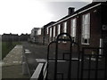
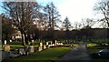
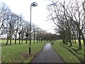
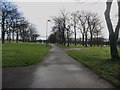

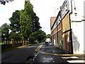
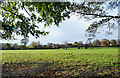
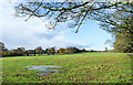
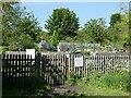

44 photos from this area
Area Information
Key information about the NE4 9SY including its size, population, and administrative classification.
- Area Type
- Postcode
- Area Size
- 1.1 hectares
- Population
- 1768
- Population Density
- 7095 people/km²
House Prices in NE4 9SY
38
Properties
£96,750
Average Sold Price
£58,000
Lowest Price
£115,000
Highest Price
Showing 38 properties
| Address | Type | Beds | Baths | Last Sale Price | Last Sale Date | |
|---|---|---|---|---|---|---|
| 41 Queensway, Fenham, Newcastle Upon Tyne, NE4 9SY | Terraced | 2 | 1 | £92,500 | Jun 2019 | |
| 29 Queensway, Fenham, Newcastle Upon Tyne, NE4 9SY | house | - | - | £58,000 | Nov 2009 | |
| 51 Queensway, Fenham, Newcastle Upon Tyne, NE4 9SY | Semi-detached | - | - | £115,000 | Mar 2007 | |
| 27 Queensway, Fenham, Newcastle Upon Tyne, NE4 9SY | house | - | - | £90,000 | Jan 2007 | |
| 58 Queensway, Fenham, Newcastle Upon Tyne, NE4 9SY | Semi-detached | 3 | 1 | £115,000 | Dec 2006 | |
| 35 Queensway, Fenham, Newcastle Upon Tyne, NE4 9SY | Semi-detached | - | - | £110,000 | May 2005 | |
| 32 Queensway, Fenham, Newcastle Upon Tyne, NE4 9SY | Semi-detached | 2 | - | - | - | |
| 32 Queensway, Fenham, Newcastle Upon Tyne, NE4 9SY | undefined | - | - | - | - | |
| 34 Queensway, Fenham, Newcastle Upon Tyne, NE4 9SY | undefined | - | - | - | - | |
| 45 Queensway, Fenham, Newcastle Upon Tyne, NE4 9SY | Terraced | - | - | - | - |
Page 1 of 4
Energy Efficiency in NE4 9SY
Amenities
Schools
| Rank | School | Type | Entry gender | Ages |
|---|
Explore more schools in this area
Go to Schools tabDemographics
Household Size
Family (3-5 people)
most common
Accommodation Type
Houses
most common
Tenure
45
majority
Ethnic Group
White
most common
Religion
N/A
most common
Household Composition
N/A
most common
Age
47
median
Adults (30-64 years)
most common
Household Deprivation
N/A
with no deprivation
NS-SEC
20
in Lower managerial occupations
Explore more demographic insights in this area
Go to Demographics tabPlanning
Planning Constraints
- Flood RiskPremium
- Ramsar Wetland SitesPremium
- Area of Outstanding Natural BeautyPremium
- Protected Nature ReservePremium
- Protected WoodlandPremium