Area Overview for NE4 9QN
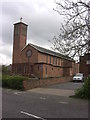
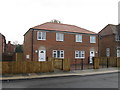
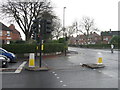
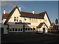
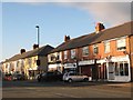
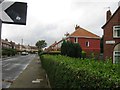
Photos of NE4 9QN


Area Information
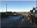
NE4 9QN is a compact residential postcode in England, covering just 1.3 hectares and home to 1,198 residents. Its high population density of 95,460 people per square kilometre reflects its small, tightly clustered nature. This area is defined by its proximity to essential services and transport links, making it a practical choice for those seeking convenience without sacrificing space. The community here is predominantly composed of adults aged 30–64, with a median age of 47, suggesting a mature, stable population. While the area is small, it offers access to nearby schools, retail hubs, and public transport, blending residential living with connectivity. The absence of significant environmental constraints, such as protected woodlands or flood zones, adds to its appeal. For buyers, NE4 9QN represents a focused, well-served neighbourhood where daily needs are met within walking or short-driving distance. Its compact size means residents are likely to know their neighbours, fostering a sense of community. However, the limited area size also means that property availability is constrained, requiring careful consideration of location within the postcode.
- Area Type
- Postcode
- Area Size
- 1.3 hectares
- Population
- 1198
- Population Density
- 95460 people/km²
NE4 9QN is a small area with a mix of owner-occupied and rental properties, though only 40% of residents are homeowners. The accommodation type is primarily houses, which is notable in a postcode of this size, suggesting a focus on single-family homes rather than apartments or terraced housing. This composition may limit the availability of properties for purchase, as the area’s compact nature means there are few plots to develop or sell. For buyers, the low home ownership rate implies a potentially competitive market, with fewer properties coming up for sale. The presence of houses may appeal to those seeking space, but the limited size of the postcode means that proximity to amenities is critical. The area’s immediate surroundings likely include more extensive housing stock, but NE4 9QN itself is best suited for those prioritising proximity to transport, retail, and schools over expansive property options.
House Prices in NE4 9QN
Showing 38 properties
| Address | Type | Beds | Baths | Last Sale Price | Last Sale Date | |
|---|---|---|---|---|---|---|
| 44 Linden Avenue, Fenham, Newcastle Upon Tyne, NE4 9QN | Semi-detached | 3 | 1 | £145,000 | Oct 2025 | |
| 48 Linden Avenue, Fenham, Newcastle Upon Tyne, NE4 9QN | Terraced | 2 | 1 | £62,500 | Apr 2024 | |
| 12 Linden Avenue, Fenham, Newcastle Upon Tyne, NE4 9QN | Terraced | 5 | - | £124,500 | Sep 2022 | |
| 11 Linden Avenue, Fenham, Newcastle Upon Tyne, NE4 9QN | house | - | - | £114,000 | Jul 2022 | |
| 9 Linden Avenue, Fenham, Newcastle Upon Tyne, NE4 9QN | house | - | - | £120,000 | Feb 2022 | |
| 10 Linden Avenue, Fenham, Newcastle Upon Tyne, NE4 9QN | house | - | - | £115,000 | Mar 2021 | |
| 19 Linden Avenue, Fenham, Newcastle Upon Tyne, NE4 9QN | Terraced | 3 | 1 | £113,500 | Mar 2021 | |
| 4 Linden Avenue, Fenham, Newcastle Upon Tyne, NE4 9QN | Terraced | 5 | - | £210,000 | Oct 2018 | |
| 18 Linden Avenue, Fenham, Newcastle Upon Tyne, NE4 9QN | Terraced | 3 | 1 | £122,000 | May 2017 | |
| 26 Linden Avenue, Fenham, Newcastle Upon Tyne, NE4 9QN | Terraced | 3 | 2 | £57,000 | Sep 2015 |
Energy Efficiency in NE4 9QN
The lifestyle in NE4 9QN is shaped by its proximity to retail, transport, and leisure options. Within practical reach are five retail outlets, including Co-op Cedar, Tesco Fenham W, and Spar, offering everyday shopping needs. The area’s rail and metro stations—Metrocentre, Dunston, Manors, St James, Haymarket, and Monument—provide easy access to nearby towns and cities, while the Newcastle Airport is a short drive away, ideal for frequent flyers. The bus stop at Rhodes Street adds flexibility for local travel. Though the data does not mention parks or leisure facilities, the density of services suggests a focus on convenience over expansive green spaces. Residents can enjoy a mix of retail, transport, and travel options, making daily life efficient and accessible. The compact nature of the area means that amenities are clustered closely, reducing the need for long commutes.
Amenities
Schools
Residents of NE4 9QN have access to two primary schools: West Gate Community College and Rutherford School. Both are primary institutions, though no Ofsted ratings are provided in the data. The presence of two primary schools suggests a focus on early education, which is typical for areas with a stable adult population. However, the absence of secondary schools nearby may require families to look beyond the postcode for comprehensive schooling. For those prioritising primary education, the proximity of these schools is a practical advantage, reducing travel time for parents and children. The mix of school types reflects a community where families may rely on local institutions for foundational education but may need to supplement with other resources for secondary schooling.
| Rank | School | Type | Entry gender | Ages |
|---|
Explore more schools in this area
Go to Schools tabDemographics
The population of NE4 9QN is 1,198, with a median age of 47, indicating a community skewed towards middle-aged and older adults. The most common age range is 30–64, reflecting a stable demographic with fewer young families or retirees. Home ownership here is relatively low at 40%, suggesting a higher proportion of renters compared to owner-occupied properties. The primary accommodation type is houses, though the exact number of flats or other dwellings is not specified. The predominant ethnic group is White, and while no data on diversity or deprivation is provided, the age profile and ownership figures imply a community focused on established living rather than rapid growth. The high population density, combined with the age distribution, suggests a mix of long-term residents and those seeking proximity to services. For buyers, this profile may indicate a market with limited turnover but strong stability, though the lack of younger demographics could affect school demand or local amenities.
Household Size
Accommodation Type
Tenure
Ethnic Group
Religion
Household Composition
Age
Household Deprivation
NS-SEC
Explore more demographic insights in this area
Go to Demographics tabPlanning
Planning Constraints
- Flood RiskPremium
- Ramsar Wetland SitesPremium
- Area of Outstanding Natural BeautyPremium
- Protected Nature ReservePremium
- Protected WoodlandPremium