Area Overview for NE4 9PQ
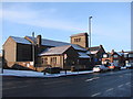
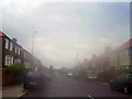
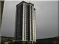
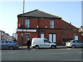
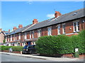
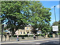
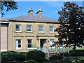
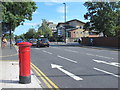
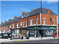
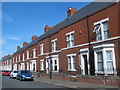
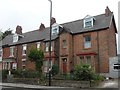
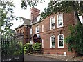
Photos of NE4 9PQ
Area Information
NE4 9PQ is a small residential cluster in England, covering 6,823 square metres and home to 1,953 residents. Its high population density of 286,238 people per square kilometre suggests a compact, closely knit community. The area is distinct for its predominantly Asian population, with a median age of 47, indicating a mature demographic skewed towards adults aged 30–64. Daily life here is shaped by proximity to essential services, including retail hubs like Asda Benwell and Tesco Fenham W, as well as transport links such as Metrocentre Railway Station and Central Station. The area’s small size means it is likely integrated with surrounding neighbourhoods, offering a mix of local amenities and access to broader urban infrastructure. While the data does not specify historical or cultural context, the presence of independent schools like Grainger Grammar School and a blend of retail and transport options suggest a functional, practical lifestyle. For buyers, this postcode represents a focused, community-oriented environment with clear access to key services.
- Area Type
- Postcode
- Area Size
- 6823 m²
- Population
- 1953
- Population Density
- 286238 people/km²
The property market in NE4 9PQ is defined by a 47% home ownership rate, suggesting that less than half of properties are owner-occupied, with the remainder likely in the rental sector. The area’s accommodation type is predominantly houses, which may appeal to families seeking more space than flats. Given the postcode’s small size, the housing stock is likely limited in volume, potentially making the market competitive for buyers. The presence of houses rather than flats could also indicate a focus on traditional family homes, which may align with the area’s demographic of adults aged 30–64. For buyers, this suggests a niche market where properties are scarce, and proximity to amenities like schools and transport hubs is a key consideration. The small area size means that immediate surroundings, such as nearby towns or suburbs, may hold additional housing options.
House Prices in NE4 9PQ
Showing 2 properties
| Address | Type | Beds | Baths | Last Sale Price | Last Sale Date | |
|---|---|---|---|---|---|---|
| Diva Newcastle Domestic Violence Forum, Saint John House, 437 Westgate Road, Newcastle Upon Tyne, NE4 9PQ | Office | - | - | - | - | |
| West End Befrienders, Saint John House, 437 Westgate Road, Newcastle Upon Tyne, NE4 9PQ | Office | - | - | - | - |
Energy Efficiency in NE4 9PQ
Living in NE4 9PQ offers access to a range of practical amenities within reach. Retail options include Asda Benwell, Tesco Fenham W, and other local stores, providing everyday shopping convenience. The area’s transport links, such as Metrocentre Railway Station and Dunston Railway Station, connect residents to broader networks, while the nearby Newcastle Airport facilitates travel. For leisure, the proximity to Metro stations and rail services may grant access to cultural or recreational hubs in nearby towns. The small size of the area means that amenities are likely concentrated in nearby clusters, but the presence of multiple retail and transport points suggests a functional lifestyle. While no parks or leisure facilities are explicitly listed, the density of services implies that residents can meet most needs without long commutes. The mix of retail, transport, and nearby schools contributes to a practical, community-focused daily life.
Amenities
Schools
Nearby schools include St Michael’s RC Junior School, a primary school, and Grainger Grammar School, an independent institution. These options provide a mix of state and private education, offering families flexibility. The presence of an independent school may attract households prioritising specific curricula or facilities, while the primary school caters to younger children. However, no Ofsted ratings or academic performance data are provided, so prospective parents should conduct further research. The combination of school types suggests a range of educational choices, though the small area’s size may limit the number of options. For families, the proximity of these schools to NE4 9PQ could be a significant draw, particularly if they align with the community’s demographic of working-age adults.
| Rank | School | Type | Entry gender | Ages |
|---|
Explore more schools in this area
Go to Schools tabDemographics
The population of NE4 9PQ is 1,953, with a median age of 47 and the majority of residents aged between 30 and 64. This suggests a community of working-age adults, possibly with families. Home ownership in the area stands at 47%, meaning nearly half of residents rent their homes. The predominant accommodation type is houses, which contrasts with areas where flats are more common. The Asian_total ethnic group is the largest demographic, though specific data on other groups is not provided. The high population density—286,238 people per square kilometre—indicates a compact living environment, which may influence the character of local interactions and the availability of shared spaces. While no deprivation data is explicitly stated, the high density and mix of ownership and rental properties could imply a balance between established residents and newer arrivals.
Household Size
Accommodation Type
Tenure
Ethnic Group
Religion
Household Composition
Age
Household Deprivation
NS-SEC
Explore more demographic insights in this area
Go to Demographics tabPlanning
Planning Constraints
- Flood RiskPremium
- Ramsar Wetland SitesPremium
- Area of Outstanding Natural BeautyPremium
- Protected Nature ReservePremium
- Protected WoodlandPremium