Area Overview for NE4 9AN
Photos of NE4 9AN


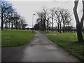


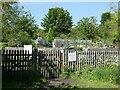
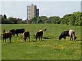

44 photos from this area
Area Information
Key information about the NE4 9AN including its size, population, and administrative classification.
- Area Type
- Postcode
- Area Size
- 1.7 hectares
- Population
- 2628
- Population Density
- 152321 people/km²
House Prices in NE4 9AN
42
Properties
£84,469
Average Sold Price
£19,000
Lowest Price
£125,000
Highest Price
Showing 42 properties
| Address | Type | Beds | Baths | Last Sale Price | Last Sale Date | |
|---|---|---|---|---|---|---|
| 7 Wingrove Avenue, Newcastle Upon Tyne, NE4 9AN | Flat | 2 | 1 | £107,000 | Feb 2024 | |
| 79 Wingrove Avenue, Newcastle Upon Tyne, NE4 9AN | Flat | 2 | 1 | £75,000 | Jan 2024 | |
| 37 Wingrove Avenue, Newcastle Upon Tyne, NE4 9AN | Flat | - | - | £110,000 | Oct 2023 | |
| 35 Wingrove Avenue, Newcastle Upon Tyne, NE4 9AN | Flat | - | - | £110,000 | Oct 2023 | |
| 33 Wingrove Avenue, Newcastle Upon Tyne, NE4 9AN | Flat | 2 | 1 | £112,000 | Mar 2019 | |
| 61 Wingrove Avenue, Newcastle Upon Tyne, NE4 9AN | Maisonette | 1 | 2 | £125,000 | Jan 2018 | |
| 13 Wingrove Avenue, Newcastle Upon Tyne, NE4 9AN | Maisonette | - | - | £92,000 | Feb 2017 | |
| 51 Wingrove Avenue, Newcastle Upon Tyne, NE4 9AN | Flat | - | - | £75,000 | Oct 2016 | |
| 59 Wingrove Avenue, Newcastle Upon Tyne, NE4 9AN | Flat | 2 | 1 | £103,500 | Mar 2008 | |
| 67 Wingrove Avenue, Newcastle Upon Tyne, NE4 9AN | Flat | 2 | 1 | £102,000 | Nov 2006 |
Page 1 of 5
Energy Efficiency in NE4 9AN
Amenities
Schools
| Rank | School | Type | Entry gender | Ages |
|---|
Explore more schools in this area
Go to Schools tabDemographics
Household Size
Family (3-5 people)
most common
Accommodation Type
Flats
most common
Tenure
26
majority
Ethnic Group
White
most common
Religion
N/A
most common
Household Composition
N/A
most common
Age
22
median
Young Adults (15-29 years)
most common
Household Deprivation
N/A
with no deprivation
NS-SEC
20
in Lower managerial occupations
Explore more demographic insights in this area
Go to Demographics tabPlanning
Planning Constraints
- Flood RiskPremium
- Ramsar Wetland SitesPremium
- Area of Outstanding Natural BeautyPremium
- Protected Nature ReservePremium
- Protected WoodlandPremium