Area Overview for NE4 8ET
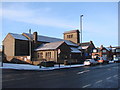
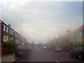
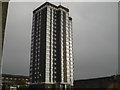
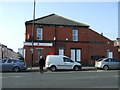
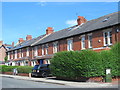
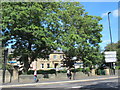
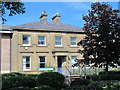
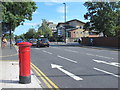
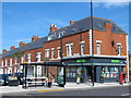
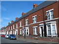
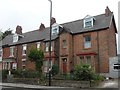
Photos of NE4 8ET

Area Information
NE4 8ET is a small residential postcode in England, home to around 1,632 people. It is a compact area where daily life is shaped by its proximity to transport hubs and retail centres. The community is characterised by a mix of younger residents and adults in their 30s to 60s, with a median age of 22. While the area lacks natural features like protected woodlands or AONBs, it benefits from low flood risk and minimal environmental constraints. Residents have access to nearby retail outlets, including Asda Benwell and Tesco Fenham W, and are within reach of Newcastle Airport. The area’s digital connectivity is strong, with a broadband score of 100, though mobile coverage is slightly lower at 85. Despite its small size, NE4 8ET offers a practical location for those prioritising transport links and convenience, though its high crime risk score of 12/100 requires careful consideration.
- Area Type
- Postcode
- Area Size
- Not available
- Population
- 1632
- Population Density
- 12420 people/km²
NE4 8ET is a rental-dominated area, with only 8% of residents owning their homes. The housing stock is almost entirely composed of flats, which are typical for small, densely populated postcode clusters. This makes the area more suited to renters than buyers seeking owner-occupied properties. The limited availability of owner-occupied homes means that buyers may need to look beyond the immediate area for more varied options. The focus on flats also suggests a practical, space-efficient housing model, though it may not appeal to those prioritising larger properties. For those considering the area, understanding the rental market dynamics is key, as property values and availability are likely to reflect the high proportion of leaseholds.
House Prices in NE4 8ET
No properties found in this postcode.
Energy Efficiency in NE4 8ET
Daily life in NE4 8ET is shaped by its proximity to retail and transport hubs. Residents have access to five retail outlets, including Asda Benwell and Lidl Benwell, offering convenience for shopping. The area’s rail and metro stations, such as Manors and Monument, provide easy access to nearby cities and suburbs, while Newcastle Airport is within reach for travel. Though the area lacks dedicated parks or leisure facilities, the practical reach of amenities supports a lifestyle focused on efficiency. The combination of retail, transport, and travel options makes NE4 8ET a functional choice for those prioritising connectivity over leisure spaces.
Amenities
Schools
The nearest school to NE4 8ET is Canning Street Primary School, which is rated ‘good’ by Ofsted. This provides a solid foundation for younger families, though the area lacks secondary schools, requiring students to travel to nearby districts. The absence of other schools in the immediate vicinity means that families should plan for additional travel time for secondary education. The presence of a well-rated primary school is a positive for those prioritising early education, but the limited range of school types may necessitate looking beyond NE4 8ET for comprehensive schooling options.
| Rank | School | Type | Entry gender | Ages |
|---|
Explore more schools in this area
Go to Schools tabDemographics
The population of NE4 8ET is 1,632, with a median age of 22, though the most common age range is adults aged 30–64. This suggests a community that includes younger residents alongside a stable adult population. Home ownership is exceptionally low at 8%, indicating that the majority of residents are renters. The accommodation type is predominantly flats, which aligns with the small, compact nature of the area. The predominant ethnic group is White, though specific diversity data is not provided. The low home ownership rate may reflect a transient population or a focus on rental properties. For those considering living here, the demographic profile suggests a mix of young professionals and families, with limited long-term residency patterns.
Household Size
Accommodation Type
Tenure
Ethnic Group
Religion
Household Composition
Age
Household Deprivation
NS-SEC
Explore more demographic insights in this area
Go to Demographics tabPlanning
Planning Constraints
- Flood RiskPremium
- Ramsar Wetland SitesPremium
- Area of Outstanding Natural BeautyPremium
- Protected Nature ReservePremium
- Protected WoodlandPremium