Area Overview for NE39 2DJ
Photos of NE39 2DJ
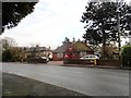
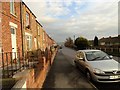
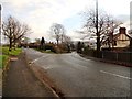
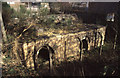
8 photos from this area
Area Information
Key information about the NE39 2DJ including its size, population, and administrative classification.
- Area Type
- Postcode
- Area Size
- 2990 m²
- Population
- 1441
- Population Density
- 144 people/km²
House Prices in NE39 2DJ
16
Properties
£66,787
Average Sold Price
£20,000
Lowest Price
£95,000
Highest Price
Showing 16 properties
| Address | Type | Beds | Baths | Last Sale Price | Last Sale Date | |
|---|---|---|---|---|---|---|
| 12 South View East, Highfield, Rowlands Gill, NE39 2DJ | house | - | - | £72,000 | Jun 2025 | |
| 1A South View East, Highfield, Rowlands Gill, NE39 2DJ | Flat | - | - | £84,000 | Nov 2023 | |
| 6 South View East, Highfield, Rowlands Gill, NE39 2DJ | Terraced | 2 | 1 | £78,000 | Aug 2023 | |
| 8 South View East, Highfield, Rowlands Gill, NE39 2DJ | Terraced | 2 | 1 | £74,000 | Nov 2021 | |
| 16 South View East, Highfield, Rowlands Gill, NE39 2DJ | house | - | - | £45,500 | May 2021 | |
| 2 South View East, Highfield, Rowlands Gill, NE39 2DJ | house | 2 | 1 | £67,000 | Apr 2021 | |
| 13 South View East, Highfield, Rowlands Gill, NE39 2DJ | Terraced | 3 | 3 | £68,995 | Sep 2017 | |
| 11 South View East, Highfield, Rowlands Gill, NE39 2DJ | Terraced | - | - | £95,000 | Sep 2007 | |
| 3 South View East, Highfield, Rowlands Gill, NE39 2DJ | Terraced | - | - | £86,000 | Sep 2006 | |
| 14 South View East, Highfield, Rowlands Gill, NE39 2DJ | Terraced | - | - | £79,950 | Jul 2006 |
Page 1 of 2
Energy Efficiency in NE39 2DJ
Amenities
Schools
| Rank | School | Type | Entry gender | Ages |
|---|
Explore more schools in this area
Go to Schools tabDemographics
Household Size
Two person
most common
Accommodation Type
Houses
most common
Tenure
61
majority
Ethnic Group
White
most common
Religion
N/A
most common
Household Composition
N/A
most common
Age
47
median
Adults (30-64 years)
most common
Household Deprivation
N/A
with no deprivation
NS-SEC
28
in Lower managerial occupations
Explore more demographic insights in this area
Go to Demographics tabPlanning
Planning Constraints
- Flood RiskPremium
- Ramsar Wetland SitesPremium
- Area of Outstanding Natural BeautyPremium
- Protected Nature ReservePremium
- Protected WoodlandPremium