Area Overview for NE39 1WZ
Photos of NE39 1WZ


Area Information
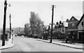
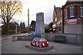
Living in NE39 1WZ means being part of a tightly knit residential cluster in England, where 1,338 people reside across a compact area. With a population density of 1,085 people per square kilometre, this postcode area reflects a mix of established homes and community-centric living. The area’s character is shaped by its proximity to retail hubs like Tesco Rowlands and Co-op Burnopfield, as well as accessible rail links such as Blaydon Railway Station and Metrocentre Railway Station. Daily life here is defined by practicality, with residents benefiting from a balance of local amenities and connections to broader transport networks. The predominantly adult population, many aged 30–64, suggests a mature, stable community. While the area lacks natural or protected landscapes, its low flood risk and manageable crime score of 69/100 indicate a safe, low-stress environment. For those seeking a residential area with straightforward access to shopping, rail, and a quiet lifestyle, NE39 1WZ offers a focused, no-frills alternative to larger urban centres.
- Area Type
- Postcode
- Area Size
- Not available
- Population
- 1338
- Population Density
- 1085 people/km²
The property market in NE39 1WZ is dominated by owner-occupied homes, with 87% of residents living in properties they own. This high rate of home ownership suggests a stable, long-term community with limited rental activity. The accommodation type is predominantly houses, which is unusual in many modern residential areas, indicating a focus on traditional, family-oriented housing. This could appeal to buyers seeking spacious, established homes but may limit availability for those prioritising flats or newer developments. The small size of the area means the housing stock is likely uniform, with limited variation in property styles or ages. For buyers, this could mean a straightforward market with predictable demand, though the lack of rental properties might reduce flexibility for those considering investment or temporary stays. The absence of planning constraints such as protected woodlands or Areas of Outstanding Natural Beauty may also make the area more attractive to developers or buyers seeking ease of modification.
House Prices in NE39 1WZ
No properties found in this postcode.
Energy Efficiency in NE39 1WZ
The lifestyle in NE39 1WZ is shaped by its proximity to essential amenities, including retail outlets like Tesco Rowlands, Co-op Burnopfield, and Co-op Whickham. These stores provide convenient access to groceries and everyday essentials, reducing the need for long journeys. The area’s rail network, with stations such as Blaydon, Metrocentre, and Dunston, connects residents to nearby towns and shopping centres, while metro stops like Central Station, St James, and Gateshead offer further links to urban hubs. Though the area lacks parks or leisure facilities, the practical reach of retail and transport options ensures a functional daily life. The compact nature of NE39 1WZ means residents can access these amenities without significant travel time, supporting a lifestyle that prioritises convenience and efficiency.
Amenities
Schools
| Rank | School | Type | Entry gender | Ages |
|---|
Explore more schools in this area
Go to Schools tabDemographics
The community in NE39 1WZ is predominantly composed of adults aged 30–64, with a median age of 47. This suggests a mature population, likely with established careers and families. Home ownership is high, with 87% of residents owning their homes, reflecting a stable, long-term demographic. The area is characterised by houses rather than flats, indicating a focus on family-friendly housing stock. The predominant ethnic group is White, though specific data on diversity is not provided. The high population density of 1,085 people per square kilometre implies a compact, possibly multi-generational living environment. While no deprivation data is available, the combination of high home ownership and low crime risk suggests a relatively secure, self-sufficient community. However, the lack of protected natural areas or cultural amenities may appeal more to those prioritising practicality over scenic or recreational features.
Household Size
Accommodation Type
Tenure
Ethnic Group
Religion
Household Composition
Age
Household Deprivation
NS-SEC
Explore more demographic insights in this area
Go to Demographics tabPlanning
Planning Constraints
- Flood RiskPremium
- Ramsar Wetland SitesPremium
- Area of Outstanding Natural BeautyPremium
- Protected Nature ReservePremium
- Protected WoodlandPremium