Area Overview for NE39 1DG
Photos of NE39 1DG
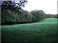
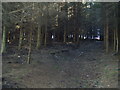


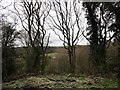
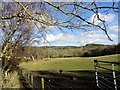

35 photos from this area
Area Information
Key information about the NE39 1DG including its size, population, and administrative classification.
- Area Type
- Postcode
- Area Size
- 5.3 hectares
- Population
- 1596
- Population Density
- 246 people/km²
House Prices in NE39 1DG
20
Properties
£224,935
Average Sold Price
£53,000
Lowest Price
£400,000
Highest Price
Showing 20 properties
| Address | Type | Beds | Baths | Last Sale Price | Last Sale Date | |
|---|---|---|---|---|---|---|
| Beech Cottage, Lintzford Road, Lintzford, Rowlands Gill, NE39 1DG | Terraced | 2 | 1 | £187,100 | Nov 2023 | |
| Brownrigg, Lintzford Road, Lintzford, Rowlands Gill, NE39 1DG | Semi-detached | 3 | 2 | £400,000 | Jun 2023 | |
| Benouhr, Lintzford Road, Lintzford, Rowlands Gill, NE39 1DG | house | - | - | £261,750 | Mar 2023 | |
| Woodside Cottage, Lintzford Road, Lintzford, Rowlands Gill, NE39 1DG | house | - | - | £293,000 | Dec 2021 | |
| Ferndale, Lintzford Road, Lintzford, Rowlands Gill, NE39 1DG | Semi-detached | 2 | 1 | £207,500 | Apr 2021 | |
| Ravensdale, Lintzford Road, Lintzford, Rowlands Gill, NE39 1DG | Semi-detached | 3 | 1 | £245,000 | Sep 2019 | |
| Middleton House, Lintzford Road, Lintzford, Rowlands Gill, NE39 1DG | Semi-detached | 3 | 1 | £180,000 | Jan 2016 | |
| Dalegarth, Lintzford Road, Lintzford, Rowlands Gill, NE39 1DG | house | - | - | £340,000 | Apr 2012 | |
| Fir Cottage, Lintzford Road, Lintzford, Rowlands Gill, NE39 1DG | Semi-detached | 2 | 1 | £53,000 | Dec 1995 | |
| Quebec House, Lintzford Road, Lintzford, Rowlands Gill, NE39 1DG | Semi-detached | - | - | £82,000 | May 1995 |
Page 1 of 2
Energy Efficiency in NE39 1DG
Amenities
Schools
| Rank | School | Type | Entry gender | Ages |
|---|
Explore more schools in this area
Go to Schools tabDemographics
Household Size
Two person
most common
Accommodation Type
Houses
most common
Tenure
84
majority
Ethnic Group
White
most common
Religion
N/A
most common
Household Composition
N/A
most common
Age
47
median
Adults (30-64 years)
most common
Household Deprivation
N/A
with no deprivation
NS-SEC
42
in Lower managerial occupations
Explore more demographic insights in this area
Go to Demographics tabPlanning
Planning Constraints
- Flood RiskPremium
- Ramsar Wetland SitesPremium
- Area of Outstanding Natural BeautyPremium
- Protected Nature ReservePremium
- Protected WoodlandPremium