Area Overview for NE38 9DY
Photos of NE38 9DY
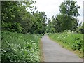
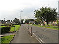

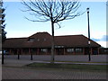
8 photos from this area
Area Information
Key information about the NE38 9DY including its size, population, and administrative classification.
- Area Type
- Postcode
- Area Size
- 9379 m²
- Population
- 1369
- Population Density
- 145967 people/km²
House Prices in NE38 9DY
34
Properties
£111,084
Average Sold Price
£39,000
Lowest Price
£237,000
Highest Price
Showing 34 properties
| Address | Type | Beds | Baths | Last Sale Price | Last Sale Date | |
|---|---|---|---|---|---|---|
| 34 Sheridan Green, Washington, NE38 9DY | Semi-detached | 4 | 2 | £237,000 | Aug 2025 | |
| 26 Sheridan Green, Washington, NE38 9DY | Semi-detached | 2 | 1 | £145,000 | Aug 2025 | |
| 14 Sheridan Green, Washington, NE38 9DY | Terraced | 3 | 2 | £165,000 | Dec 2023 | |
| 2 Sheridan Green, Washington, NE38 9DY | house | - | - | £140,000 | May 2023 | |
| 29 Sheridan Green, Washington, NE38 9DY | house | - | - | £118,000 | Jun 2021 | |
| 7 Sheridan Green, Washington, NE38 9DY | Semi-detached | 2 | - | £127,000 | Apr 2021 | |
| 22 Sheridan Green, Washington, NE38 9DY | Semi-detached | 3 | 1 | £152,000 | Aug 2019 | |
| 13 Sheridan Green, Washington, NE38 9DY | Semi-detached | 4 | 2 | £185,000 | Sep 2018 | |
| 17 Sheridan Green, Washington, NE38 9DY | house | - | - | £106,500 | Sep 2015 | |
| 18 Sheridan Green, Washington, NE38 9DY | Semi-detached | 2 | 1 | £93,000 | Oct 2010 |
Page 1 of 4
Energy Efficiency in NE38 9DY
Amenities
Schools
| Rank | School | Type | Entry gender | Ages |
|---|
Explore more schools in this area
Go to Schools tabDemographics
Household Size
N/A
most common
Accommodation Type
N/A
most common
Tenure
N/A
majority
Ethnic Group
N/A
most common
Religion
N/A
most common
Household Composition
N/A
most common
Age
N/A
median
N/A
most common
Household Deprivation
N/A
with no deprivation
NS-SEC
N/A
in Lower managerial occupations
Explore more demographic insights in this area
Go to Demographics tabPlanning
Planning Constraints
- Flood RiskPremium
- Ramsar Wetland SitesPremium
- Area of Outstanding Natural BeautyPremium
- Protected Nature ReservePremium
- Protected WoodlandPremium