Area Overview for NE37 1AP
Photos of NE37 1AP

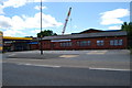
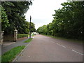
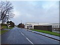
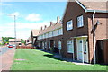
11 photos from this area
Area Information
Key information about the NE37 1AP including its size, population, and administrative classification.
- Area Type
- Postcode
- Area Size
- 7950 m²
- Population
- 1255
- Population Density
- 157869 people/km²
House Prices in NE37 1AP
25
Properties
£69,571
Average Sold Price
£23,500
Lowest Price
£135,000
Highest Price
Showing 25 properties
| Address | Type | Beds | Baths | Last Sale Price | Last Sale Date | |
|---|---|---|---|---|---|---|
| 50 Brackenway, Albany, Washington, NE37 1AP | house | - | - | £102,500 | Dec 2022 | |
| 54 Brackenway, Albany, Washington, NE37 1AP | Terraced | 3 | 1 | £97,400 | Sep 2022 | |
| 52 Brackenway, Albany, Washington, NE37 1AP | Terraced | 3 | 1 | £93,500 | Apr 2021 | |
| 48 Brackenway, Albany, Washington, NE37 1AP | house | 3 | - | £135,000 | Jan 2020 | |
| 34 Brackenway, Albany, Washington, NE37 1AP | Flat | - | - | £49,000 | Jul 2019 | |
| 33 Brackenway, Albany, Washington, NE37 1AP | Flat | - | - | £64,500 | Jul 2014 | |
| 37 Brackenway, Albany, Washington, NE37 1AP | Flat | 2 | - | £75,000 | Sep 2012 | |
| 42 Brackenway, Albany, Washington, NE37 1AP | Flat | - | - | £79,950 | Jan 2010 | |
| 32 Brackenway, Albany, Washington, NE37 1AP | Flat | - | - | £85,000 | Mar 2008 | |
| 55 Brackenway, Albany, Washington, NE37 1AP | house | - | - | £112,000 | May 2007 |
Page 1 of 3
Energy Efficiency in NE37 1AP
Amenities
Schools
| Rank | School | Type | Entry gender | Ages |
|---|
Explore more schools in this area
Go to Schools tabDemographics
Household Size
N/A
most common
Accommodation Type
N/A
most common
Tenure
N/A
majority
Ethnic Group
N/A
most common
Religion
N/A
most common
Household Composition
N/A
most common
Age
N/A
median
N/A
most common
Household Deprivation
N/A
with no deprivation
NS-SEC
N/A
in Lower managerial occupations
Explore more demographic insights in this area
Go to Demographics tabPlanning
Planning Constraints
- Flood RiskPremium
- Ramsar Wetland SitesPremium
- Area of Outstanding Natural BeautyPremium
- Protected Nature ReservePremium
- Protected WoodlandPremium