Area Overview for NE36 0YS
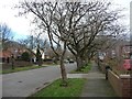
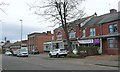
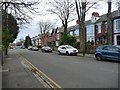
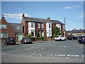
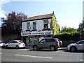
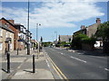
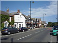
Photos of NE36 0YS

Area Information
Living in NE36 0YS means being part of a small, tightly knit residential cluster in England. With a population of 1,382 spread across a density of 415 people per square kilometre, this area feels deliberately compact, fostering a sense of community. The postcode covers a mix of housing types, predominantly owner-occupied homes, which suggests a stable, long-term resident base. Daily life here is shaped by proximity to essential services, including two primary schools with good Ofsted ratings, and a range of transport options. The area’s low population density contrasts with its accessibility to nearby amenities, making it a practical choice for those seeking balance between quiet living and connectivity. Residents benefit from proximity to retail hubs like Sainsburys East and local railway stations, while the surrounding geography avoids major environmental constraints. NE36 0YS is not a sprawling suburb but a focused, manageable neighbourhood where local needs are met without the sprawl of larger urban areas.
- Area Type
- Postcode
- Area Size
- Not available
- Population
- 1382
- Population Density
- 415 people/km²
NE36 0YS is primarily an owner-occupied area, with 88% of homes owned by residents rather than rented. This high home ownership rate suggests a community of long-term residents, which often correlates with established local networks and lower rental demand. The accommodation type is predominantly houses, which is unusual in areas with higher flat or apartment density. This mix of housing stock implies a focus on family homes, potentially appealing to buyers seeking space and privacy. Given the small size of the postcode, the property market here is likely limited to a handful of listings, making it a niche area for buyers prioritising specific needs like proximity to schools or transport. The lack of rental properties also means the market is less influenced by transient populations.
House Prices in NE36 0YS
No properties found in this postcode.
Energy Efficiency in NE36 0YS
The lifestyle in NE36 0YS is shaped by its proximity to a range of amenities. Retail options include Sainsburys East, Tesco Whiteleas, and Heron Boldon, offering everyday shopping needs. The area’s transport links, such as East Boldon Railway Station and nearby ferry terminals, facilitate access to larger towns and cities. While parks or leisure facilities are not explicitly listed, the absence of environmental constraints like AONB or protected woodlands suggests open spaces may be available nearby. The mix of retail, transport, and local services creates a practical, convenience-driven lifestyle, ideal for those prioritising accessibility over sprawling green spaces.
Amenities
Schools
Residents of NE36 0YS have access to two primary schools: East Boldon Infants’ School and East Boldon Junior School. Both institutions hold a ‘good’ Ofsted rating, indicating they meet national standards in teaching quality and student outcomes. The presence of two primary schools within the area provides families with options for early education, reducing the need for long commutes. While secondary education is not listed in the data, the proximity to nearby towns may offer additional choices. The mix of primary schools ensures coverage for younger children, making the area appealing to families prioritising educational quality.
| Rank | School | Type | Entry gender | Ages |
|---|
Explore more schools in this area
Go to Schools tabDemographics
NE36 0YS has a median age of 47, with the majority of residents falling into the 30-64 age range. This suggests a community of established adults, likely with families, given the 88% home ownership rate. The accommodation is predominantly houses, indicating a preference for single-family living over flats or apartments. The predominant ethnic group is White, reflecting a homogenous demographic profile. With such a high proportion of homeowners, the area likely experiences lower turnover, contributing to a stable, long-term community feel. The absence of specific data on deprivation means this section focuses solely on the provided figures, which highlight a mature, settled population with clear housing preferences.
Household Size
Accommodation Type
Tenure
Ethnic Group
Religion
Household Composition
Age
Household Deprivation
NS-SEC
Explore more demographic insights in this area
Go to Demographics tabPlanning
Planning Constraints
- Flood RiskPremium
- Ramsar Wetland SitesPremium
- Area of Outstanding Natural BeautyPremium
- Protected Nature ReservePremium
- Protected WoodlandPremium