Area Overview for NE36 0TW
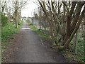
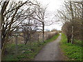
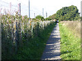
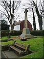
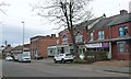
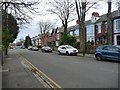
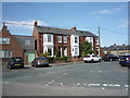
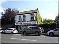
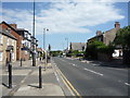
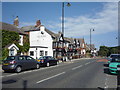
Photos of NE36 0TW


Area Information
NE36 0TW is a small, tightly knit residential cluster in England, home to 1,461 people spread across a compact area. With a population density of 898 people per square kilometre, this postcode reflects a community that values proximity and convenience. The area’s character is shaped by its mix of established residents and a median age of 47, with the majority of residents falling in the 30–64 age range. This suggests a stable, family-oriented demographic, with 90% of homes owned outright, indicating long-term residency and a sense of permanence. Daily life here is grounded in local amenities, from nearby shops to accessible transport links. The area’s small scale means it is not a sprawling suburb but a focused, walkable neighbourhood. While it lacks the vibrancy of larger urban centres, its quiet, residential nature offers a tranquil alternative for those seeking a slower pace. The presence of a nursery school and multiple transport options within a short distance hints at a practical, community-focused lifestyle. For buyers, NE36 0TW offers a snapshot of a well-established, low-maintenance area with clear advantages for those prioritising safety, stability, and ease of access to essential services.
- Area Type
- Postcode
- Area Size
- Not available
- Population
- 1461
- Population Density
- 898 people/km²
NE36 0TW is primarily an owner-occupied area, with 90% of homes owned by their residents. This high rate of home ownership suggests a community of long-term residents who have invested in their properties, which can be a draw for buyers seeking stability and potential equity growth. The accommodation type is predominantly houses, which contrasts with areas where flats or apartments dominate. This means the housing stock here is likely to be larger, with more garden space and private outdoor areas, appealing to families or those prioritising space. However, the small scale of the area—defined as a “specific postcode covering a small residential cluster”—means the number of available properties is limited. Buyers should consider the immediate surrounding areas for a broader selection. The focus on owner-occupied homes also implies a rental market that may be smaller or less dynamic, which could affect investment opportunities. For those seeking a family home with a sense of permanence, NE36 0TW offers a straightforward, low-risk proposition.
House Prices in NE36 0TW
No properties found in this postcode.
Energy Efficiency in NE36 0TW
The lifestyle in NE36 0TW is shaped by its proximity to a range of amenities, including retail, transport, and leisure options. Local shops such as Sainsburys East, Tesco Whiteleas, and Heron Boldon provide everyday essentials, while the area’s rail, metro, and ferry connections ensure easy access to broader shopping and entertainment hubs. The presence of multiple railway stations—East Boldon, Brockley Whins, and Seaburn—alongside metro stops like Pallion and Simonside means residents can reach major cities or towns quickly. Ferry terminals at Newcastle International and South Shields offer additional travel options, particularly for those needing to cross the river or travel to nearby coastal areas. A single bus stop at Rhodes Street adds to the transport network. While the data does not mention parks or leisure facilities explicitly, the area’s compact size and transport links suggest it is well-integrated into surrounding regions, allowing residents to enjoy a mix of local convenience and wider opportunities.
Amenities
Schools
The nearest school to NE36 0TW is Helen Gibson Nursery School, which provides early years education. No primary or secondary schools are listed in the data, meaning families with older children may need to look further afield for schooling options. The presence of a nursery school is a practical advantage for parents of young children, offering a local resource for early education and childcare. However, the absence of additional schools in the immediate vicinity could be a limitation for families requiring a full range of educational facilities. This suggests that while the area caters to the youngest age group, it may not be ideal for those needing comprehensive schooling within walking distance. Prospective buyers with school-aged children should investigate nearby towns or suburbs for secondary education options, as the data does not indicate proximity to larger schools.
| Rank | School | Type | Entry gender | Ages |
|---|
Explore more schools in this area
Go to Schools tabDemographics
The population of NE36 0TW is predominantly composed of adults aged 30–64, with a median age of 47. This age group suggests a community of middle-aged residents, many of whom may be in their peak earning years or raising families. The high home ownership rate of 90% indicates a strong sense of local investment and long-term residency, which often correlates with stable, low-turnover neighbourhoods. The area is largely composed of houses, reflecting a preference for single-family living over flats or apartments. The predominant ethnic group is White, which aligns with broader regional demographics but offers insight into the cultural composition of the area. While no specific data on deprivation is provided, the high home ownership and low population density suggest a relatively affluent or stable community. This stability may translate to lower pressure on local services and a more predictable quality of life. However, the absence of detailed diversity metrics means the full range of community experiences here remains unexplored.
Household Size
Accommodation Type
Tenure
Ethnic Group
Religion
Household Composition
Age
Household Deprivation
NS-SEC
Explore more demographic insights in this area
Go to Demographics tabPlanning
Planning Constraints
- Flood RiskPremium
- Ramsar Wetland SitesPremium
- Area of Outstanding Natural BeautyPremium
- Protected Nature ReservePremium
- Protected WoodlandPremium