Area Overview for NE36 0PF
Photos of NE36 0PF
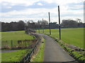
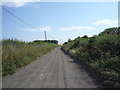
![The edge of the village [East Boldon] in NE36 0PF](https://images.propbar.co.uk/images/geograph/53/03/5303156_120.jpg)
12 photos from this area
Area Information
Key information about the NE36 0PF including its size, population, and administrative classification.
- Area Type
- Postcode
- Area Size
- 3.2 hectares
- Population
- 1382
- Population Density
- 415 people/km²
House Prices in NE36 0PF
6
Properties
£233,367
Average Sold Price
£82,600
Lowest Price
£392,500
Highest Price
Showing 6 properties
| Address | Type | Beds | Baths | Last Sale Price | Last Sale Date | |
|---|---|---|---|---|---|---|
| The Sycamores, Bridle Path, East Boldon, NE36 0PF | Bungalow | 3 | 1 | £225,000 | May 2020 | |
| Sandalwood, Bridle Path, East Boldon, NE36 0PF | house | 5 | - | £392,500 | Nov 2011 | |
| Bridle Cottage, Bridle Path, East Boldon, NE36 0PF | house | - | - | £82,600 | Mar 2004 | |
| Tennis 27M From Sandalwood, Bridle Path 44M From Unnamed Road, Bridle Path, East Boldon, NE36 0PF | Leisure | - | - | - | - | |
| Chards, Bridle Path, East Boldon, NE36 0PF | Semi-detached | - | - | - | - | |
| Orchard House, Dipe Lane, East Boldon, NE36 0PF | Bungalow | - | - | - | - |
Energy Efficiency in NE36 0PF
Amenities
Schools
| Rank | School | Type | Entry gender | Ages |
|---|
Explore more schools in this area
Go to Schools tabDemographics
Household Size
Two person
most common
Accommodation Type
Houses
most common
Tenure
88
majority
Ethnic Group
White
most common
Religion
N/A
most common
Household Composition
N/A
most common
Age
47
median
Adults (30-64 years)
most common
Household Deprivation
N/A
with no deprivation
NS-SEC
49
in Lower managerial occupations
Explore more demographic insights in this area
Go to Demographics tabPlanning
Planning Constraints
- Flood RiskPremium
- Ramsar Wetland SitesPremium
- Area of Outstanding Natural BeautyPremium
- Protected Nature ReservePremium
- Protected WoodlandPremium