Area Overview for NE36 0AD
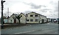
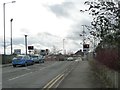
Photos of NE36 0AD
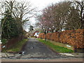
![Junction of Woodlands Road and Whitburn Road [B1299] in NE36 0AD](https://images.propbar.co.uk/images/geograph/53/02/5302753_120.jpg)
Area Information
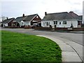
Living in NE36 0AD offers a compact, residential experience shaped by its small cluster of homes and proximity to essential services. With a population of 1,461 and a density of 898 people per square kilometre, this area balances community cohesion with practicality. The demographic profile suggests a mature, stable population, with adults aged 30–64 forming the majority. Daily life here is likely defined by routine access to nearby amenities, from retail hubs to transport links. The absence of major environmental constraints, such as protected woodlands or AONB areas, means development is unencumbered, though the area remains low-risk for flooding and crime. Its strategic placement near rail, metro, and ferry routes ensures connectivity to Newcastle, South Shields, and beyond. For those seeking a quiet, established neighbourhood with minimal planning restrictions, NE36 0AD provides a straightforward, functional base. The high home ownership rate of 90% underscores its appeal to long-term residents, though the small size means the housing market is tightly focused.
- Area Type
- Postcode
- Area Size
- Not available
- Population
- 1461
- Population Density
- 898 people/km²
The property market in NE36 0AD is dominated by owner-occupied homes, with 90% of residents living in houses rather than flats or rented properties. This suggests a focus on family homes and long-term residency, rather than a rental market or high-density housing. The small area size means the housing stock is limited, but the high home ownership rate indicates strong demand from local buyers. For those considering the area, this dynamic could mean fewer properties are available for purchase, but those on the market are likely to be in good condition, reflecting the stability of the community. The absence of planning constraints, such as protected nature reserves or AONB areas, also means development is less restricted, though the small footprint of the area limits expansion. Buyers should expect a market where properties are held by residents with long-term intentions, potentially leading to a slower turnover of listings.
House Prices in NE36 0AD
No properties found in this postcode.
Energy Efficiency in NE36 0AD
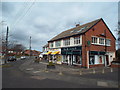
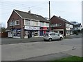
Daily life in NE36 0AD is supported by a range of nearby amenities, including five retail outlets such as Sainsburys East and Tesco Whiteleas, ensuring easy access to groceries and household essentials. The area’s transport links also provide opportunities for leisure, with ferry terminals offering trips to nearby coastal areas and rail stations connecting to cultural hubs in Newcastle. While the data does not list specific parks or recreational spaces, the absence of protected natural areas suggests that local green spaces may be limited. The presence of multiple rail, metro, and ferry options enhances mobility, allowing residents to explore nearby towns or commute to urban centres. The compact nature of the area means amenities are within practical reach, though the lack of detailed information on dining or leisure venues means further local investigation would be necessary to fully assess the lifestyle options available.
Amenities
Schools
The nearest school to NE36 0AD is Helen Gibson Nursery School, which provides early education services for young children. No other schools are listed in the data, so families with older children may need to look further afield for primary or secondary education. The presence of a nursery indicates that the area is accessible to young families, though the lack of additional schools suggests that parents may need to travel to nearby towns for broader educational options. This could be a consideration for buyers prioritising proximity to schools, as the current infrastructure is limited to early years provision. The absence of data on school Ofsted ratings means further research would be needed to assess quality, but the availability of a nursery alone offers a practical starting point for families.
| Rank | School | Type | Entry gender | Ages |
|---|
Explore more schools in this area
Go to Schools tabDemographics
NE36 0AD’s population skews towards adults aged 30–64, with a median age of 47. This suggests a community of established professionals and families, likely with strong ties to local institutions. The 90% home ownership rate indicates a stable, owner-occupied demographic, with houses forming the primary accommodation type. The predominant ethnic group is White, reflecting a homogenous population profile. While no specific deprivation data is provided, the high home ownership and low crime risk suggest a relatively affluent, secure environment. The absence of younger age groups or student populations means the area is less likely to experience the transient dynamics of student housing or rental-driven turnover. For buyers, this translates to a market where properties are likely to remain in private hands, with fewer speculative pressures. The demographic stability also implies predictable demand for local services, from schools to retail.
Household Size
Accommodation Type
Tenure
Ethnic Group
Religion
Household Composition
Age
Household Deprivation
NS-SEC
Explore more demographic insights in this area
Go to Demographics tabPlanning
Planning Constraints
- Flood RiskPremium
- Ramsar Wetland SitesPremium
- Area of Outstanding Natural BeautyPremium
- Protected Nature ReservePremium
- Protected WoodlandPremium