Area Overview for NE34 9UA
Photos of NE34 9UA
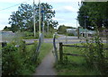
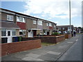
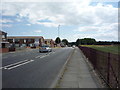
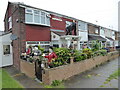
18 photos from this area
Area Information
Key information about the NE34 9UA including its size, population, and administrative classification.
- Area Type
- Postcode
- Area Size
- 7.2 hectares
- Population
- 1461
- Population Density
- 898 people/km²
House Prices in NE34 9UA
91
Properties
£80,547
Average Sold Price
£28,500
Lowest Price
£136,040
Highest Price
Showing 91 properties
| Address | Type | Beds | Baths | Last Sale Price | Last Sale Date | |
|---|---|---|---|---|---|---|
| 87 Heaton Gardens, South Shields, NE34 9UA | Terraced | 3 | 1 | £136,040 | Jan 2025 | |
| 71 Heaton Gardens, South Shields, NE34 9UA | Terraced | 3 | 1 | £96,000 | Jan 2024 | |
| 75 Heaton Gardens, South Shields, NE34 9UA | Flat | 1 | 1 | £39,950 | Dec 2023 | |
| 183 Heaton Gardens, South Shields, NE34 9UA | Semi-detached | 3 | 1 | £130,000 | Aug 2023 | |
| 73 Heaton Gardens, South Shields, NE34 9UA | Flat | - | - | £39,000 | Apr 2022 | |
| 123 Heaton Gardens, South Shields, NE34 9UA | house | 3 | 1 | £105,000 | Mar 2022 | |
| 199 Heaton Gardens, South Shields, NE34 9UA | house | - | - | £122,500 | Jan 2022 | |
| 159 Heaton Gardens, South Shields, NE34 9UA | Semi-detached | 3 | 1 | £120,000 | Nov 2021 | |
| 134 Heaton Gardens, South Shields, NE34 9UA | Terraced | - | - | £70,000 | Nov 2021 | |
| 185 Heaton Gardens, South Shields, NE34 9UA | Semi-detached | 3 | 1 | £127,000 | Sep 2021 |
Page 1 of 10
Energy Efficiency in NE34 9UA
Amenities
Schools
| Rank | School | Type | Entry gender | Ages |
|---|
Explore more schools in this area
Go to Schools tabDemographics
Household Size
Two person
most common
Accommodation Type
Houses
most common
Tenure
90
majority
Ethnic Group
White
most common
Religion
N/A
most common
Household Composition
N/A
most common
Age
47
median
Adults (30-64 years)
most common
Household Deprivation
N/A
with no deprivation
NS-SEC
47
in Lower managerial occupations
Explore more demographic insights in this area
Go to Demographics tabPlanning
Planning Constraints
- Flood RiskPremium
- Ramsar Wetland SitesPremium
- Area of Outstanding Natural BeautyPremium
- Protected Nature ReservePremium
- Protected WoodlandPremium