Area Overview for NE34 9PX
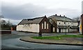
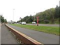
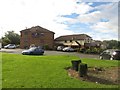
Photos of NE34 9PX


Area Information
NE34 9PX is a small, tightly knit residential area in England, home to 1,315 residents. It occupies a compact footprint, typical of a postcode cluster that prioritises local living over sprawling development. The area’s character is defined by its proximity to essential services and transport links, making it a practical choice for those seeking a balance between urban convenience and residential tranquillity. With a median age of 47, the community leans towards middle-aged adults, suggesting a stable population with established roots. Daily life here revolves around nearby amenities, including retail outlets, public transport hubs, and schools. The area’s modest size means residents are likely to know their neighbours, fostering a sense of familiarity. While it lacks the density of larger cities, NE34 9PX offers access to regional infrastructure, such as ferry terminals and rail networks, which connect it to Newcastle and South Shields. This blend of local charm and connectivity positions it as a viable option for those seeking a self-contained, low-maintenance lifestyle.
- Area Type
- Postcode
- Area Size
- Not available
- Population
- 1315
- Population Density
- 1796 people/km²
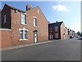
NE34 9PX is predominantly an owner-occupied area, with 63% of homes owned by residents rather than rented. The accommodation type is exclusively houses, which is unusual for a small postcode area but suggests a focus on family homes and single-unit properties. This composition implies a market where buyers are likely to prioritise space and privacy over high-density living. The limited number of properties in the area means the housing stock is unlikely to be vast, which could make the market competitive for those seeking a home. Given the high home ownership rate, rental options may be scarce, potentially limiting choices for tenants. For buyers, the area’s small size means the immediate surroundings are critical—any nearby developments or extensions would significantly impact availability. The presence of houses rather than flats also suggests a market tailored to those seeking traditional, long-term residential solutions.
House Prices in NE34 9PX
No properties found in this postcode.
Energy Efficiency in NE34 9PX
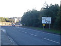
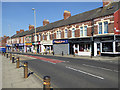
The lifestyle in NE34 9PX is shaped by its proximity to a range of amenities, including retail, transport, and leisure facilities. Supermarkets such as Asda Simonside, Lidl Tyne, and Sainsburys Simonside provide daily shopping convenience, while the area’s five metro stations, five rail stations, and two ferry terminals ensure easy access to regional hubs. The presence of multiple transport options, including the Rhodes Street bus route, enhances connectivity for both commuting and leisure travel. For residents, this means a lifestyle that blends local convenience with the ability to travel further afield. The variety of transport links also supports a dynamic social life, with opportunities to explore nearby towns and attractions. The area’s small size means amenities are tightly clustered, creating a compact, efficient environment where residents can access essentials without long journeys.
Amenities
Schools
The nearest school to NE34 9PX is Lord Blyton Primary School, which serves the local community with primary education. Its Ofsted rating is satisfactory, indicating that it meets basic standards but may not exceed them. The absence of secondary schools in the immediate vicinity means families with older children may need to look beyond the area for secondary education. This dynamic could influence decisions about where to live, as parents may prioritise proximity to a full range of educational stages. The single primary school available suggests that the area’s school infrastructure is limited, though it fulfils the needs of younger children. For those requiring secondary schooling, commuting to nearby towns such as Newcastle or South Shields would be necessary. The mix of school types here is minimal, reflecting the small scale of the area and its focus on primary education.
| Rank | School | Type | Entry gender | Ages |
|---|
Explore more schools in this area
Go to Schools tabDemographics
The population of NE34 9PX is predominantly adults aged 30–64, with a median age of 47. This suggests a community of settled individuals, likely with established careers and families. Home ownership is high at 63%, indicating a strong presence of long-term residents rather than transient renters. The accommodation type is primarily houses, which aligns with the area’s residential focus and the preference for single-family homes. The predominant ethnic group is White, reflecting a homogenous demographic profile. While this data does not provide direct insight into deprivation levels, the high home ownership rate and stable age distribution may correlate with a relatively low dependency on social services. However, the absence of specific deprivation metrics means broader socioeconomic factors remain unexplored. The area’s demographic makeup suggests a community that values stability and continuity, with limited diversity in terms of age and background.
Household Size
Accommodation Type
Tenure
Ethnic Group
Religion
Household Composition
Age
Household Deprivation
NS-SEC
Explore more demographic insights in this area
Go to Demographics tabPlanning
Planning Constraints
- Flood RiskPremium
- Ramsar Wetland SitesPremium
- Area of Outstanding Natural BeautyPremium
- Protected Nature ReservePremium
- Protected WoodlandPremium