Area Overview for NE34 9PD
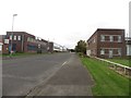
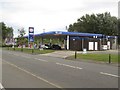
Photos of NE34 9PD


Area Information
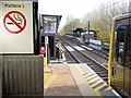
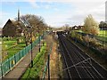
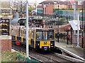
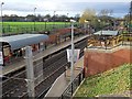
Living in NE34 9PD offers a compact, residential experience with a population of 1,539, reflecting a small, tightly knit community. This postcode area is characterised by its proximity to key transport hubs, including five metro stations such as Bede and Simonside, and three rail stations like Brockley Whins and Heworth. Residents benefit from nearby retail options, including Tesco South and Asda Simonside, as well as ferry access to Newcastle and South Shields. The area’s housing stock is predominantly composed of houses, catering to a population with a median age of 47, where adults aged 30–64 form the largest demographic. While the area enjoys excellent broadband connectivity and a practical range of amenities, potential buyers should note the higher crime risk, which requires attention to security measures. NE34 9PD balances convenience with the challenges of a smaller, less densely populated setting, making it suitable for those prioritising accessibility over urban vibrancy.
- Area Type
- Postcode
- Area Size
- Not available
- Population
- 1539
- Population Density
- 1880 people/km²
The property market in NE34 9PD is defined by a 42% home ownership rate, indicating a balance between owner-occupied homes and rental properties. The predominant accommodation type is houses, which suggests a focus on family-sized or standalone residences rather than apartments or flats. This structure may appeal to buyers seeking traditional housing with garden space, though the small population and limited area size mean the housing stock is not extensive. The immediate surroundings offer similar options, but buyers should consider broader regional markets for more choice. The relatively low home ownership rate also implies a significant portion of the housing is let, which could influence property availability and competition. For those prioritising ownership, the area’s proximity to transport and retail may outweigh the need for larger property selections, but buyers should assess the local market’s responsiveness to demand.
House Prices in NE34 9PD
No properties found in this postcode.
Energy Efficiency in NE34 9PD
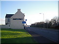
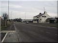
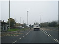
Residents of NE34 9PD have access to a range of amenities within walking or short driving distance. Retail options include major supermarkets such as Tesco South, Sainsburys Simonside, and Asda Simonside, ensuring everyday shopping needs are met. The area’s proximity to metro stations like Bede and Simonside, along with rail services at Brockley Whins and Heworth, facilitates easy travel to nearby towns. Ferry access to Newcastle International and South Shields terminals adds flexibility for regional travel. A single bus stop at Rhodes Street complements the transport network. While the area lacks extensive parks or leisure facilities, its practical amenities and transport links create a functional lifestyle, ideal for those prioritising convenience over expansive recreational spaces. The combination of retail, transport, and nearby services supports a straightforward, accessible daily routine.
Amenities
Schools
| Rank | School | Type | Entry gender | Ages |
|---|
Explore more schools in this area
Go to Schools tabDemographics
NE34 9PD has a median age of 47, with the majority of residents falling within the 30–64 age range, indicating a mature, stable population. Home ownership stands at 42%, suggesting a mix of owner-occupied properties and rental stock. The area is predominantly White, reflecting a homogenous ethnic profile. The presence of houses as the primary accommodation type aligns with the demographic’s preference for family-friendly or long-term living. With a population of 1,539, the area lacks the density of larger cities but offers a quieter, more contained environment. The absence of specific deprivation data means quality of life is inferred from amenities and safety assessments. However, the high crime risk score of 24/100 highlights a need for caution, particularly in ensuring household security. This profile suggests a community focused on stability, with residents likely prioritising proximity to transport and retail over urban amenities.
Household Size
Accommodation Type
Tenure
Ethnic Group
Religion
Household Composition
Age
Household Deprivation
NS-SEC
Explore more demographic insights in this area
Go to Demographics tabPlanning
Planning Constraints
- Flood RiskPremium
- Ramsar Wetland SitesPremium
- Area of Outstanding Natural BeautyPremium
- Protected Nature ReservePremium
- Protected WoodlandPremium