Area Overview for NE34 9BR
Photos of NE34 9BR


Area Information
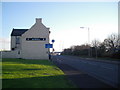
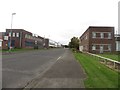
Living in NE34 9BR means being part of a tightly knit residential cluster in England, where the population of 1,315 residents reflects a community shaped by stability and local ties. This postcode area is characterised by its modest size and proximity to essential services, making it a practical choice for those seeking a balanced lifestyle. The median age of 47 suggests a mature demographic, with adults aged 30–64 forming the majority. Daily life here is underpinned by a mix of traditional housing and accessible amenities. The area’s low flood risk and absence of environmental constraints like protected woodlands or AONB designations mean residents face minimal geographical challenges. Connectivity is strong, with broadband scores near 96 and mobile coverage rated 85, supporting both work and leisure. While not a sprawling suburb, NE34 9BR offers a quiet, functional environment with nearby retail, transport, and community hubs. For those prioritising practicality over urban vibrancy, this area provides a foundation for a stable, low-maintenance existence.
- Area Type
- Postcode
- Area Size
- Not available
- Population
- 1315
- Population Density
- 1796 people/km²
The property market in NE34 9BR is defined by a 63% home ownership rate, indicating a balance between owner-occupied homes and rental properties. The accommodation type is predominantly houses, which may suggest a focus on family-sized dwellings or single-family homes. This contrasts with areas dominated by apartments or flats, offering a different dynamic for buyers. Given the small postcode area, the housing stock is likely limited in scale, with properties clustered around local amenities. For buyers, this means a market where demand may be driven by those seeking traditional housing rather than investment opportunities. The lack of large-scale developments or commercial properties implies a niche market, where properties are likely to be more individualised. The absence of specific price data means assessing value requires local knowledge, but the emphasis on houses suggests a focus on long-term residency over short-term rental yields.
House Prices in NE34 9BR
No properties found in this postcode.
Energy Efficiency in NE34 9BR
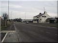
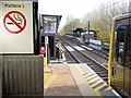
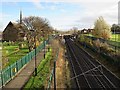
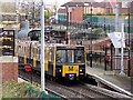
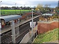
Daily life in NE34 9BR is supported by a range of nearby amenities, from retail to transport. Sainsburys and Asda in Simonside provide essential shopping, while Tesco South adds to the variety of grocery options. The area’s railway stations, including Brockley Whins and Seaburn, offer connections to larger towns and cities, complemented by ferry terminals at Newcastle and South Shields for those needing coastal access. The presence of five metro stations and a single bus stop at Rhodes Street ensures multiple transport choices. For leisure, the area’s proximity to the Tyne and Wear Metro system allows easy access to cultural and recreational sites. While the data does not specify parks or leisure facilities, the availability of retail, transport, and community hubs suggests a lifestyle focused on practicality and connectivity. The mix of amenities caters to both daily needs and occasional outings, supporting a functional, accessible living environment.
Amenities
Schools
The nearest school to NE34 9BR is Lord Blyton Primary School, which serves the local community with primary education. Its Ofsted rating of satisfactory indicates a school that meets minimum standards but may not excel in areas like pupil outcomes or staff performance. As the only named school in the data, it highlights a reliance on primary education for families in the area. The absence of secondary schools or other educational institutions within the data means parents may need to look further afield for secondary education. For families prioritising proximity to schools, Lord Blyton Primary offers a basic level of service, but the lack of additional educational options could be a consideration for those requiring a broader range of facilities.
| Rank | School | Type | Entry gender | Ages |
|---|
Explore more schools in this area
Go to Schools tabDemographics
The community in NE34 9BR is predominantly composed of adults aged 30–64, with a median age of 47. This suggests a population largely in their prime working years, potentially shaping the area’s dynamics. Home ownership stands at 63%, indicating a mix of owner-occupied properties and rental units. The accommodation type is primarily houses, which may reflect a preference for family-friendly living. The predominant ethnic group is White, though specific data on diversity or deprivation is not provided. The age profile and ownership figures suggest a stable, long-term resident base, with fewer transient populations. For quality of life, the absence of specific deprivation metrics means assumptions about affordability or social services are not supported by the data. The demographic makeup aligns with a mature, settled community, where housing stock and local amenities cater to established households.
Household Size
Accommodation Type
Tenure
Ethnic Group
Religion
Household Composition
Age
Household Deprivation
NS-SEC
Explore more demographic insights in this area
Go to Demographics tabPlanning
Planning Constraints
- Flood RiskPremium
- Ramsar Wetland SitesPremium
- Area of Outstanding Natural BeautyPremium
- Protected Nature ReservePremium
- Protected WoodlandPremium