Area Overview for NE34 8YZ
Photos of NE34 8YZ

Area Information
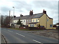
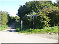
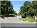
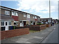
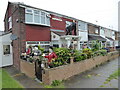
NE34 8YZ is a small, tightly knit residential cluster in England, home to 1,359 people. Its compact size fosters a quiet, community-oriented atmosphere, where daily life revolves around local amenities and nearby transport links. The area’s character is defined by its modest scale, with no sprawling developments or commercial hubs. Residents benefit from proximity to multiple railway stations, including East Boldon and Seaburn, which connect to broader networks. The postcode’s proximity to Newcastle International Ferry Terminal and South Shields Ferry Terminal also offers access to coastal travel. While the population is small, the area’s infrastructure ensures practical connectivity. The median age of 47 suggests a mature demographic, with many residents likely established in their careers or retirement. This makes NE34 8YZ appealing to those seeking stability, though the limited population means social networks are likely tight-knit. Living here involves balancing the convenience of nearby shops, such as Tesco Whiteleas and Sainsburys East, with the quietude of a low-density residential environment. The area’s small footprint means it’s ideal for buyers prioritising simplicity over sprawling urban sprawl.
- Area Type
- Postcode
- Area Size
- Not available
- Population
- 1359
- Population Density
- Not available
The property market in NE34 8YZ is characterised by a 52% home ownership rate, with houses making up the majority of accommodation. This suggests a market skewed towards owner-occupation rather than rental properties, though the small population size means the inventory of homes is limited. The predominance of houses over flats or apartments indicates a preference for traditional, possibly larger properties, which may appeal to families or retirees. However, the area’s compact nature means buyers should consider the scarcity of new developments. The low population density also implies that properties are likely to be spread out, with limited immediate competition. For those seeking a home, the market may offer fewer choices but potentially more characterful options. The 52% home ownership rate also suggests a moderate level of rental activity, though the exact proportion of rental properties is not specified. Buyers should be prepared for a market where each property is distinct, with no large-scale housing projects influencing prices or availability.
House Prices in NE34 8YZ
No properties found in this postcode.
Energy Efficiency in NE34 8YZ
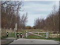
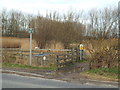
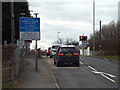
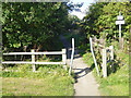
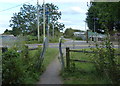
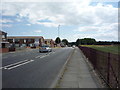
Living in NE34 8YZ offers access to a range of practical amenities within short distances. The retail options include major chains like Tesco Whiteleas, Spar Ridgeway, and Sainsburys East, ensuring everyday shopping needs are met. For transport, the area is served by five railway stations, including East Boldon and Seaburn, and three metro stations such as Tyne Dock. Ferry terminals at Newcastle International and South Shields provide coastal travel options, while a single bus stop at Rhodes Street connects to local routes. Though the area is small, the variety of transport links suggests it is well-integrated with surrounding regions. The presence of multiple stations and terminals indicates a focus on connectivity, making it easier for residents to commute or travel. The retail and transport infrastructure combined creates a functional lifestyle, where daily errands and travel are efficiently managed without the need for long journeys.
Amenities
Schools
| Rank | School | Type | Entry gender | Ages |
|---|
Explore more schools in this area
Go to Schools tabDemographics
The community in NE34 8YZ is predominantly composed of adults aged 30–64, with a median age of 47. This suggests a population largely in their prime working years or nearing retirement. Home ownership stands at 52%, indicating a mix of owner-occupied properties and rental units. The accommodation type is primarily houses, which is unusual for areas with higher flat density. The predominant ethnic group is White, with no data provided on other demographics. The absence of specific information on diversity or deprivation means the area’s social fabric remains opaque, but the age profile and home ownership rate suggest a stable, settled population. The 52% home ownership rate implies a moderate rental market, though the small population size limits the availability of diverse housing options. For buyers, this means properties are likely to be family homes rather than investment opportunities. The age range also hints at a community with established routines, potentially less transient than younger demographics.
Household Size
Accommodation Type
Tenure
Ethnic Group
Religion
Household Composition
Age
Household Deprivation
NS-SEC
Explore more demographic insights in this area
Go to Demographics tabPlanning
Planning Constraints
- Flood RiskPremium
- Ramsar Wetland SitesPremium
- Area of Outstanding Natural BeautyPremium
- Protected Nature ReservePremium
- Protected WoodlandPremium