Area Overview for NE34 8PX
Photos of NE34 8PX
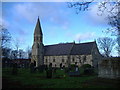
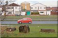
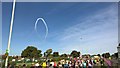
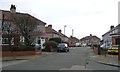
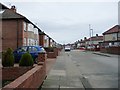
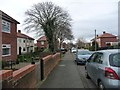
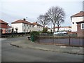
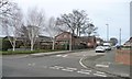
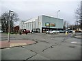
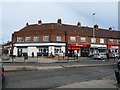
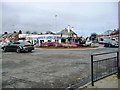
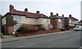
19 photos from this area
Area Information
Key information about the NE34 8PX including its size, population, and administrative classification.
- Area Type
- Postcode
- Area Size
- 3776 m²
- Population
- 1467
- Population Density
- 6881 people/km²
House Prices in NE34 8PX
11
Properties
£123,221
Average Sold Price
£45,950
Lowest Price
£165,000
Highest Price
Showing 11 properties
| Address | Type | Beds | Baths | Last Sale Price | Last Sale Date | |
|---|---|---|---|---|---|---|
| 300 Sunderland Road, South Shields, NE34 8PX | Terraced | 4 | 1 | £165,000 | Jun 2022 | |
| 294 Sunderland Road, South Shields, NE34 8PX | house | - | - | £132,000 | Apr 2022 | |
| 292 Sunderland Road, South Shields, NE34 8PX | house | - | - | £115,100 | Jul 2017 | |
| 302 Sunderland Road, South Shields, NE34 8PX | Terraced | - | - | £125,000 | Aug 2007 | |
| 282 Sunderland Road, South Shields, NE34 8PX | Semi-detached | - | - | £143,000 | Jun 2007 | |
| 288 Sunderland Road, South Shields, NE34 8PX | Terraced | - | - | £136,500 | May 2005 | |
| 290 Sunderland Road, South Shields, NE34 8PX | Terraced | - | - | £45,950 | Jan 2000 | |
| 284 Sunderland Road, South Shields, NE34 8PX | Terraced | 3 | 1 | - | - | |
| 286 Sunderland Road, South Shields, NE34 8PX | Terraced | - | - | - | - | |
| 298 Sunderland Road, South Shields, NE34 8PX | Terraced | - | - | - | - |
Page 1 of 2
Energy Efficiency in NE34 8PX
Amenities
Schools
| Rank | School | Type | Entry gender | Ages |
|---|
Explore more schools in this area
Go to Schools tabDemographics
Household Size
Family (3-5 people)
most common
Accommodation Type
Houses
most common
Tenure
57
majority
Ethnic Group
White
most common
Religion
N/A
most common
Household Composition
N/A
most common
Age
47
median
Adults (30-64 years)
most common
Household Deprivation
N/A
with no deprivation
NS-SEC
20
in Lower managerial occupations
Explore more demographic insights in this area
Go to Demographics tabPlanning
Planning Constraints
- Flood RiskPremium
- Ramsar Wetland SitesPremium
- Area of Outstanding Natural BeautyPremium
- Protected Nature ReservePremium
- Protected WoodlandPremium