Area Overview for NE34 6SD
Photos of NE34 6SD
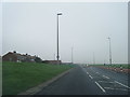
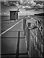
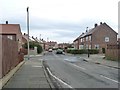
![Public footpath from Fenton Avenue to Bywell Avenue [1] in NE34 6SD](https://images.propbar.co.uk/images/geograph/53/00/5300582_120.jpg)
21 photos from this area
Area Information
Key information about the NE34 6SD including its size, population, and administrative classification.
- Area Type
- Postcode
- Area Size
- 8021 m²
- Population
- 1381
- Population Density
- 172170 people/km²
House Prices in NE34 6SD
24
Properties
-
Average Sold Price
-
Lowest Price
-
Highest Price
Showing 24 properties
| Address | Type | Beds | Baths | Last Sale Price | Last Sale Date | |
|---|---|---|---|---|---|---|
| 46 Barbour Avenue, South Shields, NE34 6SD | Semi-detached | 3 | - | - | - | |
| 39 Barbour Avenue, South Shields, NE34 6SD | Detached | 3 | 1 | - | - | |
| 37 Barbour Avenue, South Shields, NE34 6SD | Semi-detached | 3 | 1 | - | - | |
| 51 Barbour Avenue, South Shields, NE34 6SD | Semi-detached | 3 | 1 | - | - | |
| 36 Barbour Avenue, South Shields, NE34 6SD | Semi-detached | 3 | 1 | - | - | |
| 60 Barbour Avenue, South Shields, NE34 6SD | Semi-detached | - | - | - | - | |
| 38 Barbour Avenue, South Shields, NE34 6SD | house | - | - | - | - | |
| 47 Barbour Avenue, South Shields, NE34 6SD | Semi-detached | - | - | - | - | |
| 48 Barbour Avenue, South Shields, NE34 6SD | house | - | - | - | - | |
| 43 Barbour Avenue, South Shields, NE34 6SD | Semi-detached | - | - | - | - |
Page 1 of 3
Energy Efficiency in NE34 6SD
Amenities
Schools
| Rank | School | Type | Entry gender | Ages |
|---|
Explore more schools in this area
Go to Schools tabDemographics
Household Size
Family (3-5 people)
most common
Accommodation Type
Houses
most common
Tenure
65
majority
Ethnic Group
White
most common
Religion
N/A
most common
Household Composition
N/A
most common
Age
47
median
Adults (30-64 years)
most common
Household Deprivation
N/A
with no deprivation
NS-SEC
21
in Lower managerial occupations
Explore more demographic insights in this area
Go to Demographics tabPlanning
Planning Constraints
- Flood RiskPremium
- Ramsar Wetland SitesPremium
- Area of Outstanding Natural BeautyPremium
- Protected Nature ReservePremium
- Protected WoodlandPremium
- Crime & SafetyPremium