Area Overview for NE33 2PG
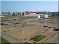
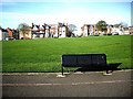
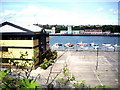
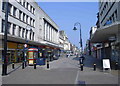
Photos of NE33 2PG


Area Information
NE33 2PG is a small, tightly knit residential postcode in England with a population of just 1,416 people. It is a compact area where daily life is shaped by its proximity to transport links and local amenities. The community here is predominantly composed of adults aged 30–64, reflecting a mature demographic profile. While the area lacks the density of larger towns, it offers a quiet, manageable environment with practical access to nearby services. Residents benefit from a mix of retail, transport, and leisure options within walking or short driving distance. The postcode’s small size means it is not a sprawling suburb but a focused cluster of homes, often flats, which dominate the housing stock. For those seeking a balance between convenience and tranquillity, NE33 2PG provides a straightforward, no-frills living experience, though its character is defined more by its practicality than by architectural or cultural landmarks.
- Area Type
- Postcode
- Area Size
- Not available
- Population
- 1416
- Population Density
- Not available
The property market in NE33 2PG is characterised by a high proportion of rented flats, with home ownership at just 37%. This indicates that the area is not primarily an owner-occupied community but rather one where rental properties dominate. The prevalence of flats suggests a focus on smaller, more manageable living spaces, which may appeal to individuals or couples rather than larger families. Given the small population and limited housing stock, the market is likely to be niche, with limited scope for expansion or development. Buyers considering the area should note that it is not a high-demand region for property investment, and the availability of flats may mean fewer options for those seeking larger homes. The compact nature of the postcode also means that the immediate surroundings are the primary source of housing choices, limiting the breadth of the property market.
House Prices in NE33 2PG
No properties found in this postcode.
Energy Efficiency in NE33 2PG
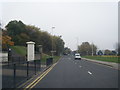
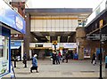
The lifestyle in NE33 2PG is shaped by its proximity to a variety of amenities within practical reach. Retail options include Morrisons South, Tesco Westoe, and Heron Market, offering everyday shopping needs. The area is also well-served by transport links, with multiple railway stations, metro services, and ferry terminals providing access to nearby towns and cities. For leisure, the presence of ferry terminals suggests opportunities for water-based activities or travel. The bus route at Rhodes Street adds to the connectivity, though it is the only bus service listed. While the area does not feature notable parks or green spaces in the data, its mix of retail, transport, and dining options indicates a functional, if unpretentious, lifestyle. Residents can expect convenience in daily errands and travel, though the absence of detailed information on recreational facilities means the area’s leisure appeal is not fully defined.
Amenities
Schools
The nearest schools to NE33 2PG include Marine Park Primary School, which is listed twice in the data. This repetition may indicate a local emphasis on primary education, though no secondary schools are named. The presence of a primary school suggests that families with young children may find the area convenient for schooling, though the absence of additional school types means that parents may need to look further afield for secondary education. The limited school options imply that the area is not a major hub for educational institutions, and families may need to consider proximity to other schools in nearby towns. The data does not provide Ofsted ratings or performance metrics, so the quality of education cannot be assessed from this information alone.
| Rank | School | Type | Entry gender | Ages |
|---|
Explore more schools in this area
Go to Schools tabDemographics
The population of NE33 2PG has a median age of 47, with the majority of residents falling within the 30–64 age range. This suggests a community that is largely in middle age, with fewer young families or elderly residents. Home ownership is relatively low at 37%, indicating that a significant portion of the housing stock is rented. The predominant accommodation type is flats, which aligns with the area’s compact nature. The predominant ethnic group is listed as Asian_total, though no further breakdown is provided. This demographic profile implies a community with established residents, possibly with long-term ties to the area. The absence of specific data on deprivation or income levels means that quality of life can only be inferred indirectly, but the age profile and housing type suggest a stable, if modest, socioeconomic environment.
Household Size
Accommodation Type
Tenure
Ethnic Group
Religion
Household Composition
Age
Household Deprivation
NS-SEC
Explore more demographic insights in this area
Go to Demographics tabPlanning
Planning Constraints
- Flood RiskPremium
- Ramsar Wetland SitesPremium
- Area of Outstanding Natural BeautyPremium
- Protected Nature ReservePremium
- Protected WoodlandPremium
- Crime & SafetyPremium