Area Overview for NE33 1SL
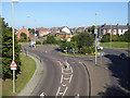
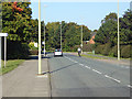
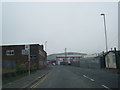
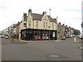
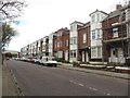
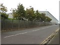
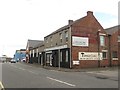
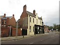
Photos of NE33 1SL


Area Information
Living in NE33 1SL means inhabiting a tightly packed residential cluster in England, where 1,705 residents share a population density of 1,612 people per square kilometre. This small postcode area is defined by its proximity to transport hubs and amenities, making it a practical choice for those prioritising convenience. The community is predominantly composed of adults aged 30–64, with a median age of 47, suggesting a mature, established demographic. Daily life here is shaped by the compact layout, with residents able to access retail, ferry services, and public transport within short distances. The area’s limited size means a close-knit environment, though the high density could imply a need for shared spaces or community coordination. For buyers, NE33 1SL offers a snapshot of urban living with a focus on connectivity, though the small footprint means choices are constrained to a specific cluster of properties and services.
- Area Type
- Postcode
- Area Size
- Not available
- Population
- 1705
- Population Density
- 1612 people/km²
NE33 1SL’s property market is characterised by a 34% home ownership rate, indicating that most residents rent their homes. The predominant accommodation type is flats, which suggests a focus on smaller, possibly older or purpose-built housing stock. This makes the area more suited to renters than buyers seeking long-term ownership. The small postcode area means the housing market is limited in scope, with properties concentrated in a compact cluster. Buyers should consider that flats may be the only available options, and the high population density could influence property prices and availability. For those prioritising proximity to transport and amenities, the area offers convenience, but the limited size may restrict choices for those seeking larger or more varied housing.
House Prices in NE33 1SL
No properties found in this postcode.
Energy Efficiency in NE33 1SL
Residents of NE33 1SL have access to a range of amenities within practical reach. Retail options include Heron Frederick, Lidl Central South, and Morrisons Daily Meldon, offering everyday shopping needs. Ferry services connect the area to Newcastle and South Shields, while metro, rail, and bus networks provide broader mobility. The presence of five metro stations and five rail stops, including Brockley Whins and Tyne Dock, suggests frequent public transport services. Though the data does not specify leisure or park facilities, the proximity to transport and retail implies a focus on convenience over expansive recreational spaces. The compact layout means amenities are closely clustered, supporting a lifestyle centred on accessibility and practicality.
Amenities
Schools
Residents of NE33 1SL have access to two primary schools in South Shields: St Bede’s RC Voluntary Aided Primary School and St Bede’s Catholic Primary School. The latter holds an outstanding Ofsted rating, reflecting high standards in education. Both schools serve the local community, offering primary-level education for children. The presence of two primary schools within the area provides families with options, though no secondary schools are listed in the data. For parents, the outstanding-rated school is a significant advantage, but those requiring secondary education may need to look further afield. The concentration of schools in South Shields suggests a focus on early education within the broader region.
| Rank | School | Type | Entry gender | Ages |
|---|
Explore more schools in this area
Go to Schools tabDemographics
The community in NE33 1SL is largely composed of adults aged 30–64, with a median age of 47, indicating a settled population. Only 34% of residents own their homes, with flats being the predominant accommodation type. This suggests a rental market with a focus on smaller, managed housing units. The majority of the population identifies as White, and the data does not indicate significant ethnic diversity. The high population density of 1,612 people per square kilometre means shared spaces and communal living are common. While no specific deprivation data is provided, the low home ownership rate and flat-based housing may reflect economic or structural factors influencing the area’s affordability and housing options.
Household Size
Accommodation Type
Tenure
Ethnic Group
Religion
Household Composition
Age
Household Deprivation
NS-SEC
Explore more demographic insights in this area
Go to Demographics tabPlanning
Planning Constraints
- Flood RiskPremium
- Ramsar Wetland SitesPremium
- Area of Outstanding Natural BeautyPremium
- Protected Nature ReservePremium
- Protected WoodlandPremium
- Crime & SafetyPremium