Area Overview for NE32 5XS
Photos of NE32 5XS
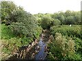

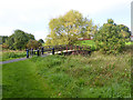
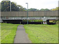
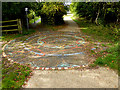
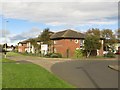
59 photos from this area
Area Information
Key information about the NE32 5XS including its size, population, and administrative classification.
- Area Type
- Postcode
- Area Size
- 1.0 hectares
- Population
- 1374
- Population Density
- 1798 people/km²
House Prices in NE32 5XS
33
Properties
£63,675
Average Sold Price
£36,000
Lowest Price
£103,000
Highest Price
Showing 33 properties
| Address | Type | Beds | Baths | Last Sale Price | Last Sale Date | |
|---|---|---|---|---|---|---|
| 34 Ashbourne Road, Jarrow, NE32 5XS | Terraced | 3 | - | £90,000 | May 2024 | |
| 7 Ashbourne Road, Jarrow, NE32 5XS | house | - | - | £103,000 | Jan 2022 | |
| 8 Ashbourne Road, Jarrow, NE32 5XS | Terraced | 3 | 1 | £65,000 | Jul 2019 | |
| 25 Ashbourne Road, Jarrow, NE32 5XS | Terraced | 3 | 1 | £67,000 | Mar 2019 | |
| 6 Ashbourne Road, Jarrow, NE32 5XS | Terraced | 3 | - | £55,500 | Aug 2014 | |
| 20 Ashbourne Road, Jarrow, NE32 5XS | Terraced | 3 | - | £40,250 | Jul 2013 | |
| 36 Ashbourne Road, Jarrow, NE32 5XS | Terraced | - | - | £40,000 | Dec 2011 | |
| 9 Ashbourne Road, Jarrow, NE32 5XS | house | 3 | - | £50,000 | Nov 2011 | |
| 23 Ashbourne Road, Jarrow, NE32 5XS | Terraced | - | - | £90,000 | Oct 2007 | |
| 31 Ashbourne Road, Jarrow, NE32 5XS | Terraced | - | - | £36,000 | Apr 1998 |
Page 1 of 4
Energy Efficiency in NE32 5XS
Amenities
Schools
| Rank | School | Type | Entry gender | Ages |
|---|
Explore more schools in this area
Go to Schools tabDemographics
Household Size
One person
most common
Accommodation Type
Houses
most common
Tenure
48
majority
Ethnic Group
White
most common
Religion
N/A
most common
Household Composition
N/A
most common
Age
47
median
Adults (30-64 years)
most common
Household Deprivation
N/A
with no deprivation
NS-SEC
22
in Lower managerial occupations
Explore more demographic insights in this area
Go to Demographics tabPlanning
Planning Constraints
- Flood RiskPremium
- Ramsar Wetland SitesPremium
- Area of Outstanding Natural BeautyPremium
- Protected Nature ReservePremium
- Protected WoodlandPremium