Area Overview for NE32 5TF
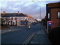
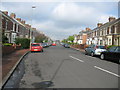
Photos of NE32 5TF

Area Information
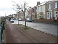
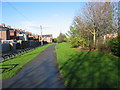
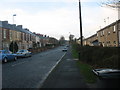
Living in NE32 5TF means being part of a small, tightly knit residential cluster in England, home to 1,374 residents. This area is defined by its modest scale and proximity to essential services, making it a practical choice for those prioritising convenience over sprawling urban sprawl. The community is predominantly composed of adults aged 30–64, with a median age of 47, suggesting a stable, mature population. Daily life here is shaped by the availability of local amenities, including multiple retail outlets and transport links. While the area does not feature natural or protected landscapes, it is well-served by infrastructure such as rail stations and ferry terminals. The digital connectivity is strong, with a broadband score of 94 and mobile coverage rated 85, ensuring reliable internet access for both work and leisure. However, the moderate crime risk score of 65 means residents should remain vigilant with standard security measures. For those seeking a balanced lifestyle with access to schools, transport, and retail, NE32 5TF offers a compact, functional environment.
- Area Type
- Postcode
- Area Size
- Not available
- Population
- 1374
- Population Density
- 1798 people/km²
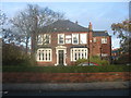
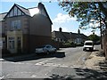
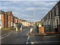
The property market in NE32 5TF is characterised by a 48% home ownership rate, suggesting a mix of owner-occupied and rental properties. The accommodation type is primarily houses, which implies a focus on family homes rather than apartments or terraced housing. This makes the area more appealing to those seeking larger living spaces, though the small population size means the housing stock is limited. Buyers should consider the proximity to amenities such as schools and transport, which may influence property values. The lack of large-scale development or commercial zones means the market is likely to remain niche, with properties catering to those prioritising convenience over expansion. For first-time buyers, the mix of owner-occupied and rental properties could present opportunities, but the area’s small size may limit options for those seeking a wide range of properties.
House Prices in NE32 5TF
No properties found in this postcode.
Energy Efficiency in NE32 5TF
The lifestyle in NE32 5TF is shaped by its proximity to a range of amenities. Retail options include Morrisons Jarrow, Iceland Jarrow, and Morrisons Daily, offering everyday shopping needs. Public transport hubs like Jarrow, Bede, and Fellgate metro stations, along with rail stations such as Heworth and East Boldon, provide easy access to nearby towns and cities. Ferry terminals at Newcastle and South Shields add flexibility for travel across the region. The area’s small size means these amenities are within practical walking or driving distance, enhancing convenience. While the data does not mention parks or leisure facilities directly, the presence of multiple transport links and retail centres suggests a functional, community-oriented lifestyle focused on accessibility and practicality.
Amenities
Schools
Residents of NE32 5TF have access to three primary schools within practical reach: Valley View Primary School, which holds an Ofsted rating of outstanding, and Jarrow School, rated good. Springfield School is also nearby but lacks an Ofsted rating in the data. The presence of both outstanding and good-rated schools suggests a strong foundation for early education, though families may need to look further for secondary schooling. The mix of primary schools provides options for parents seeking different educational approaches, with Valley View standing out as a high-performing institution. For those prioritising academic quality, the proximity to these schools is a significant advantage, particularly for families with young children.
| Rank | School | Type | Entry gender | Ages |
|---|
Explore more schools in this area
Go to Schools tabDemographics
NE32 5TF has a median age of 47, with the majority of residents falling within the 30–64 age range. This suggests a community of established adults, many of whom may be in their prime working years or nearing retirement. Home ownership in the area stands at 48%, meaning just over half of properties are owner-occupied, while the remaining 52% are likely rented. The predominant accommodation type is houses, which contrasts with areas where flats or apartments dominate. The ethnic composition is predominantly White, with no specific data on other groups provided. The absence of deprivation statistics means it is unclear how economic factors influence quality of life here, but the age profile and home ownership rates indicate a relatively stable demographic.
Household Size
Accommodation Type
Tenure
Ethnic Group
Religion
Household Composition
Age
Household Deprivation
NS-SEC
Explore more demographic insights in this area
Go to Demographics tabPlanning
Planning Constraints
- Flood RiskPremium
- Ramsar Wetland SitesPremium
- Area of Outstanding Natural BeautyPremium
- Protected Nature ReservePremium
- Protected WoodlandPremium