Area Overview for NE32 5JA
Photos of NE32 5JA
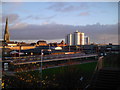
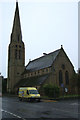

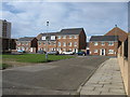
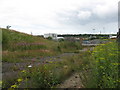
100 photos from this area
Area Information
Key information about the NE32 5JA including its size, population, and administrative classification.
- Area Type
- Postcode
- Area Size
- 2.8 hectares
- Population
- 1232
- Population Density
- 4646 people/km²
House Prices in NE32 5JA
30
Properties
£101,104
Average Sold Price
£26,400
Lowest Price
£155,000
Highest Price
Showing 30 properties
| Address | Type | Beds | Baths | Last Sale Price | Last Sale Date | |
|---|---|---|---|---|---|---|
| 186 Albert Road, Jarrow, NE32 5JA | Terraced | 4 | - | £155,000 | Apr 2024 | |
| 224 Albert Road, Jarrow, NE32 5JA | Flat | - | - | £120,000 | Jul 2023 | |
| 196 Albert Road, Jarrow, NE32 5JA | Flat | 5 | - | £147,500 | Feb 2022 | |
| 206 Albert Road, Jarrow, NE32 5JA | Terraced | 3 | 1 | £127,950 | Aug 2020 | |
| 184 Albert Road, Jarrow, NE32 5JA | Terraced | 3 | 1 | £100,000 | Jun 2019 | |
| 192 Albert Road, Jarrow, NE32 5JA | Terraced | 3 | 1 | £137,500 | May 2018 | |
| 190 Albert Road, Jarrow, NE32 5JA | Terraced | 3 | - | £70,500 | Jul 2015 | |
| 200 Albert Road, Jarrow, NE32 5JA | Terraced | 3 | 1 | £105,000 | Nov 2014 | |
| 194 Albert Road, Jarrow, NE32 5JA | Terraced | 3 | 1 | £110,000 | Aug 2012 | |
| 204 Albert Road, Jarrow, NE32 5JA | Terraced | - | - | £130,000 | Nov 2006 |
Page 1 of 3
Energy Efficiency in NE32 5JA
Amenities
Schools
| Rank | School | Type | Entry gender | Ages |
|---|
Explore more schools in this area
Go to Schools tabDemographics
Household Size
One person
most common
Accommodation Type
Houses
most common
Tenure
47
majority
Ethnic Group
White
most common
Religion
N/A
most common
Household Composition
N/A
most common
Age
47
median
Adults (30-64 years)
most common
Household Deprivation
N/A
with no deprivation
NS-SEC
20
in Lower managerial occupations
Explore more demographic insights in this area
Go to Demographics tabPlanning
Planning Constraints
- Flood RiskPremium
- Ramsar Wetland SitesPremium
- Area of Outstanding Natural BeautyPremium
- Protected Nature ReservePremium
- Protected WoodlandPremium