Area Overview for NE32 3UG
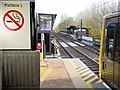
Photos of NE32 3UG


Area Information
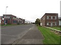
NE32 3UG is a small residential cluster in England with a population of 1539, offering a compact, close-knit community feel. The area is characterised by its modest size, making it a practical choice for those seeking a quieter, less densely populated environment. With a median age of 47, the population skews toward adults in their 30s to 60s, suggesting a stable, mature demographic. Daily life here is shaped by proximity to essential services and transport links, with retail options like Tesco South and Sainsburys Simonside within reach. The area’s housing stock is predominantly houses, reflecting a traditional, family-oriented layout. While the broadband connection is excellent, the crime risk is notably high, requiring residents to consider security measures. This postcode’s appeal lies in its balance of accessibility and tranquillity, though buyers should weigh the safety concerns against the convenience of nearby amenities and transport networks.
- Area Type
- Postcode
- Area Size
- Not available
- Population
- 1539
- Population Density
- 1880 people/km²
The property market in NE32 3UG is defined by a 42% home ownership rate, indicating that just over a third of properties are owner-occupied, while the majority are likely rented. The accommodation type is predominantly houses, which is unusual for areas with higher flat or apartment density. This suggests a traditional housing stock, possibly older, with larger properties suited to families or individuals seeking more space. As a small area, the housing market is likely limited in scale, with limited scope for new developments. Buyers should consider that the area’s small size means properties may be spread out, and the owner-occupied proportion suggests a mix of long-term residents and renters. The focus on houses may appeal to those prioritising privacy and space, but the high crime risk could influence perceptions of safety and desirability.
House Prices in NE32 3UG
No properties found in this postcode.
Energy Efficiency in NE32 3UG
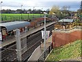
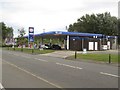
Living in NE32 3UG offers access to a range of amenities within practical reach. Retail options include major supermarkets such as Tesco South, Sainsburys Simonside, and Morrisons Daily, ensuring daily shopping needs are met. The area’s transport links enhance its lifestyle appeal, with metro stations like Bede and Simonside providing easy access to nearby towns. Rail services at Heworth and East Boldon stations connect to broader networks, while ferry terminals at Newcastle and South Shields open up regional travel possibilities. For local movement, the Rhodes Street bus route offers a basic but functional link. The presence of multiple transport hubs suggests a community that is well-integrated with surrounding areas, though the area’s small size means amenities are not densely clustered. This balance of retail, transport, and connectivity supports a practical, accessible lifestyle.
Amenities
Schools
| Rank | School | Type | Entry gender | Ages |
|---|
Explore more schools in this area
Go to Schools tabDemographics
The community in NE32 3UG is largely composed of adults aged 30–64, with a median age of 47. This suggests a mature, established population, likely with long-term ties to the area. Home ownership stands at 42%, indicating that nearly half of residents live in their own homes, while the remaining 58% are likely renters. The predominant accommodation type is houses, which may cater to families or those preferring more space. The ethnic composition is predominantly White, with no specific data on other groups provided. While deprivation levels are not explicitly stated, the relatively low home ownership rate could imply a mix of rental tenures, potentially affecting housing stability. The age profile and ownership figures together suggest a community that is neither heavily youthful nor elderly, with a focus on middle-aged residents maintaining long-term residences.
Household Size
Accommodation Type
Tenure
Ethnic Group
Religion
Household Composition
Age
Household Deprivation
NS-SEC
Explore more demographic insights in this area
Go to Demographics tabPlanning
Planning Constraints
- Flood RiskPremium
- Ramsar Wetland SitesPremium
- Area of Outstanding Natural BeautyPremium
- Protected Nature ReservePremium
- Protected WoodlandPremium