Area Overview for NE32 3SU
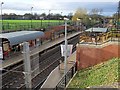
Photos of NE32 3SU


Area Information
NE32 3SU is a compact residential area in England, home to around 1,539 people. It is a small, tightly knit cluster of properties, reflecting a community where familiarity and local connections are likely to be strong. The area’s modest size means it is not sprawling, but it is well-served by nearby amenities, including supermarkets like Tesco South, Morrisons Daily, and Sainsburys Simonside, which cater to daily needs. Residents benefit from proximity to multiple metro stations—Bede, Simonside, and Jarrow—alongside rail links at Brockley Whins, East Boldon, and Heworth. These transport options provide access to larger towns and cities, though the area itself maintains a quiet, residential character. The population is predominantly adults aged 30–64, with a median age of 47, suggesting a stable, established community. While the area has no significant natural constraints like protected woodlands or wetlands, it does face a critical safety challenge: crime rates here are above average, with a safety score of 24 out of 100. This underscores the need for vigilance, but the low flood risk and strong broadband connectivity—scoring 98 out of 100—offer reassurance on other fronts. Living in NE32 3SU means balancing practicality with the realities of a small, connected but not isolated postcode.
- Area Type
- Postcode
- Area Size
- Not available
- Population
- 1539
- Population Density
- Not available
The property market in NE32 3SU is defined by a 42% home ownership rate, with houses being the primary accommodation type. This suggests a market skewed towards owner-occupation rather than rental, though the relatively low home ownership percentage implies that a significant portion of the housing stock may be available for rent or in other non-ownership arrangements. Given the area’s small size, the housing stock is likely to be limited, with properties concentrated in a compact cluster. The prevalence of houses rather than flats may appeal to buyers seeking more space or traditional living arrangements, though it could also mean fewer options for those prioritising urban convenience. For buyers considering NE32 3SU, the small scale of the area means that proximity to nearby towns and cities is key, with transport links playing a central role in connectivity. The lack of specific data on property prices or recent sales trends means that the market’s current dynamics—whether it is rising, stable, or under pressure—are not quantified. However, the presence of multiple retail and transport hubs within practical reach suggests that the area’s appeal may lie in its accessibility rather than its intrinsic property values.
House Prices in NE32 3SU
No properties found in this postcode.
Energy Efficiency in NE32 3SU
Living in NE32 3SU offers access to a range of amenities within practical reach. Retail options include major supermarkets like Tesco South, Morrisons Daily, and Sainsburys Simonside, ensuring that everyday shopping needs are met without the need for long journeys. The area’s transport links—metro stations at Bede, Simonside, and Jarrow, plus rail services at Brockley Whins, East Boldon, and Heworth—allow residents to easily access larger towns and cities for more specialised services. Ferry terminals at Newcastle International and South Shields provide additional connectivity for those who rely on maritime travel. A bus stop at Rhodes Street adds to the area’s accessibility. While the specific character of parks or leisure facilities is not detailed in the data, the presence of multiple transport and retail hubs suggests a lifestyle that balances convenience with the practicalities of a small residential area. The compact nature of NE32 3SU means that daily life is likely to revolve around these nearby amenities, creating a self-contained but connected environment.
Amenities
Schools
| Rank | School | Type | Entry gender | Ages |
|---|
Explore more schools in this area
Go to Schools tabDemographics
The community in NE32 3SU is predominantly composed of adults aged 30–64, with a median age of 47. This suggests a population that is largely in their prime working years, though the exact proportion of retirees or younger families is not specified. Home ownership here stands at 42%, indicating that nearly half of residents own their homes, while the remaining 58% may be renters or in other housing arrangements. The area is characterised by houses rather than flats, reflecting a more traditional housing stock. The predominant ethnic group is White, though no specific breakdown of other groups is provided. With a population of just 1,539, the area is small enough that social dynamics are likely to be closely knit. However, the lack of detailed data on household composition or deprivation levels means that broader quality-of-life implications—such as access to services or economic stability—remain less defined. The absence of protected natural areas or planning constraints suggests the area is not subject to restrictions that might limit development or land use, but this does not directly address the socioeconomic factors influencing daily life here.
Household Size
Accommodation Type
Tenure
Ethnic Group
Religion
Household Composition
Age
Household Deprivation
NS-SEC
Explore more demographic insights in this area
Go to Demographics tabPlanning
Planning Constraints
- Flood RiskPremium
- Ramsar Wetland SitesPremium
- Area of Outstanding Natural BeautyPremium
- Protected Nature ReservePremium
- Protected WoodlandPremium