Area Overview for NE32 3PG
Photos of NE32 3PG
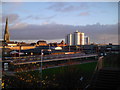
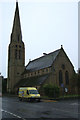

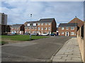
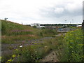
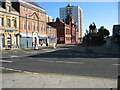
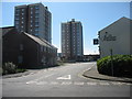
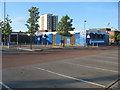
100 photos from this area
Area Information
Key information about the NE32 3PG including its size, population, and administrative classification.
- Area Type
- Postcode
- Area Size
- 8520 m²
- Population
- 1599
- Population Density
- 967 people/km²
House Prices in NE32 3PG
41
Properties
£105,770
Average Sold Price
£48,000
Lowest Price
£180,000
Highest Price
Showing 41 properties
| Address | Type | Beds | Baths | Last Sale Price | Last Sale Date | |
|---|---|---|---|---|---|---|
| 17 North Street, Jarrow, NE32 3PG | Flat | 2 | 1 | £88,000 | Jan 2025 | |
| 19 North Street, Jarrow, NE32 3PG | Flat | - | - | £80,000 | Feb 2023 | |
| 54 North Street, Jarrow, NE32 3PG | Terraced | 3 | 3 | £150,500 | Nov 2022 | |
| 40 North Street, Jarrow, NE32 3PG | Flat | 1 | 1 | £75,000 | Nov 2022 | |
| 45 North Street, Jarrow, NE32 3PG | Retail | 3 | - | £180,000 | Sep 2022 | |
| 62 North Street, Jarrow, NE32 3PG | Semi-detached | 3 | 1 | £133,000 | Aug 2022 | |
| 51 North Street, Jarrow, NE32 3PG | Semi-detached | 3 | 2 | £166,500 | Aug 2022 | |
| 37 North Street, Jarrow, NE32 3PG | Retail | 3 | 1 | £155,000 | Jul 2022 | |
| 49 North Street, Jarrow, NE32 3PG | Terraced | - | - | £137,500 | May 2022 | |
| 42 North Street, Jarrow, NE32 3PG | Flat | 3 | 1 | £72,000 | Mar 2022 |
Page 1 of 5
Energy Efficiency in NE32 3PG
Amenities
Schools
| Rank | School | Type | Entry gender | Ages |
|---|
Explore more schools in this area
Go to Schools tabDemographics
Household Size
One person
most common
Accommodation Type
Houses
most common
Tenure
27
majority
Ethnic Group
White
most common
Religion
N/A
most common
Household Composition
N/A
most common
Age
47
median
Adults (30-64 years)
most common
Household Deprivation
N/A
with no deprivation
NS-SEC
16
in Lower managerial occupations
Explore more demographic insights in this area
Go to Demographics tabPlanning
Planning Constraints
- Flood RiskPremium
- Ramsar Wetland SitesPremium
- Area of Outstanding Natural BeautyPremium
- Protected Nature ReservePremium
- Protected WoodlandPremium