Area Overview for NE32 3NJ
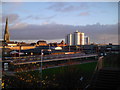
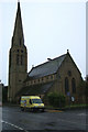
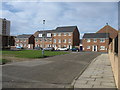
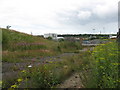
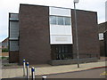
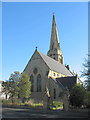
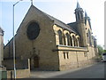
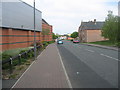
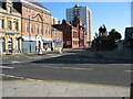
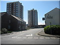
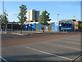
Photos of NE32 3NJ

Area Information
Living in NE32 3NJ offers a compact residential experience within a small cluster of homes, serving a population of 1,599 people. The area’s density of 967 people per square kilometre suggests a tightly knit community, though the postcode’s limited size means it is not a sprawling suburb. This area is characterised by its focus on family homes, with a median age of 47 and a majority of residents falling within the 30–64 age range. The White ethnic group is predominant, reflecting a traditional demographic profile. Daily life here is shaped by proximity to essential services, including retail outlets like Iceland Jarrow and Morrisons, as well as transport links such as Jarrow Metro station. While the area lacks large-scale amenities, its compact nature ensures residents can access nearby towns like South Shields and Newcastle for broader needs. The presence of St Peter’s CofE Primary School underscores its appeal to families, though the broader educational landscape remains limited. For those seeking a quiet, localised community with practical access to transport and retail, NE32 3NJ provides a straightforward, no-frills environment.
- Area Type
- Postcode
- Area Size
- Not available
- Population
- 1599
- Population Density
- 967 people/km²
The property market in NE32 3NJ is shaped by its low home ownership rate of 27%, suggesting that the majority of properties are rented rather than owned. The accommodation type is primarily houses, which may indicate a focus on family homes, though the data does not specify the size or style of these properties. This small postcode area likely has limited housing stock, meaning buyers must consider the broader surrounding region for more options. The low home ownership percentage implies a rental market that could offer stability for tenants but may limit opportunities for those seeking long-term investment in property. For buyers, this area may appeal to those looking for a secondary residence or a property in a quiet, localised community. However, the limited number of owner-occupied homes means competition could be fierce, and prices may reflect the area’s modest demand. The presence of nearby towns like Jarrow and South Shields could provide additional options for those willing to expand their search beyond NE32 3NJ.
House Prices in NE32 3NJ
No properties found in this postcode.
Energy Efficiency in NE32 3NJ
Residents of NE32 3NJ have access to a range of nearby amenities, including five retail outlets such as Iceland Jarrow and Morrisons Daily, which provide essential shopping options. The area’s transport links, including five Metro stations and five railway stations, offer connections to larger towns like Jarrow and South Shields. Ferry terminals in Newcastle and South Shields add further mobility, though the nearest bus stop is at Rhodes Street, which may limit local public transport options. The presence of multiple retail and transport hubs ensures daily life is manageable, though the area’s small size means residents may need to travel for more specialised services. The combination of practical amenities and transport links supports a lifestyle focused on accessibility and efficiency, making NE32 3NJ a viable choice for those prioritising convenience over extensive leisure options.
Amenities
Schools
The nearest school to NE32 3NJ is St Peter’s CofE Primary School, which serves the area’s primary education needs. No secondary schools are listed in the data, meaning families may need to travel to nearby towns for secondary education. The presence of a primary school suggests that the area is suitable for young children, though the lack of secondary options could be a limitation for families requiring a full range of educational facilities. The school’s type—Church of England—may indicate a faith-based curriculum, though no Ofsted rating is provided. For parents prioritising proximity to a primary school, NE32 3NJ offers a practical solution, but broader educational planning would need to account for the absence of secondary schools within the immediate vicinity.
| Rank | School | Type | Entry gender | Ages |
|---|
Explore more schools in this area
Go to Schools tabDemographics
The community in NE32 3NJ is predominantly composed of adults aged 30–64, with a median age of 47. This suggests a mature population, likely with established careers and family structures. Home ownership rates are low at 27%, indicating that a significant portion of residents are likely to rent their homes. The accommodation type is primarily houses, which may reflect a focus on larger properties, though the limited data does not specify the proportion of detached versus semi-detached homes. The predominant ethnic group is White, with no specific figures provided on other ethnicities. This demographic profile implies a stable, possibly working-class community, where property ownership is less common than in other areas. The low home ownership rate could influence the local property market, making it more rental-oriented. For buyers, this means a smaller pool of owner-occupied homes, with more opportunities in the rental sector. The area’s character is defined by its practicality, catering to those prioritising affordability and proximity to essential services over luxury.
Household Size
Accommodation Type
Tenure
Ethnic Group
Religion
Household Composition
Age
Household Deprivation
NS-SEC
Explore more demographic insights in this area
Go to Demographics tabPlanning
Planning Constraints
- Flood RiskPremium
- Ramsar Wetland SitesPremium
- Area of Outstanding Natural BeautyPremium
- Protected Nature ReservePremium
- Protected WoodlandPremium