Area Overview for NE32 3LT
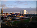
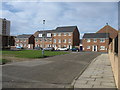
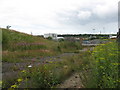
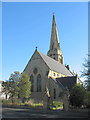
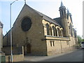
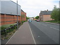
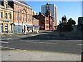
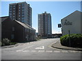
Photos of NE32 3LT


Area Information
NE32 3LT is a small residential postcode area in England, home to 1,599 people across a densely populated cluster. With 967 people per square kilometre, this area is compact but offers a mix of everyday living. The community is predominantly composed of adults aged 30–64, reflecting a mature demographic. Daily life here is shaped by proximity to essential services, with nearby schools, retail outlets, and transport links. The area’s character is defined by its accessibility to larger towns like Jarrow and South Shields, which provide additional amenities. While the population is relatively small, the density suggests a tight-knit community. Residents benefit from a blend of local shops, public transport, and connections to regional hubs. The area’s compact size means most needs are within walking or short driving distance, though it remains a niche postcode with limited data on broader cultural or recreational offerings. For buyers, NE32 3LT represents a specific, practical choice for those prioritising convenience over expansive space.
- Area Type
- Postcode
- Area Size
- Not available
- Population
- 1599
- Population Density
- 967 people/km²
The property market in NE32 3LT is defined by its low home ownership rate of 27%, which suggests that most properties are rented rather than owner-occupied. The area is dominated by houses, which is atypical for a small postcode, potentially indicating a mix of older homes and semi-detached housing. This makes the market more suited to renters or buyers seeking larger properties in a low-density setting. The limited size of the area means the housing stock is not extensive, and buyers should consider the proximity to nearby towns for additional options. With only 27% of residents owning their homes, the market may be competitive for those seeking to purchase, particularly if demand exceeds supply. The focus on houses rather than flats also means that the area is less likely to cater to younger buyers or those prioritising urban living. For those considering NE32 3LT, understanding the rental dynamics and limited property diversity is key to making an informed decision.
House Prices in NE32 3LT
No properties found in this postcode.
Energy Efficiency in NE32 3LT
Living in NE32 3LT offers access to a range of nearby amenities, from retail to transport hubs. The area is within reach of five retail outlets, including Morrisons Jarrow, Iceland Jarrow, and Morrisons Daily, providing everyday shopping needs. Residents can also reach ferry terminals at Newcastle International and South Shields, which connect to nearby towns and ports. Rail services at Brockley Whins, Heworth, and East Boldon offer frequent departures, while metro stops at Jarrow, Bede, and Howdon add to the transport network. A single bus stop at Rhodes Street provides local connectivity. Though the area itself is small, the proximity to larger towns ensures a broader selection of services. The mix of shops, transport, and regional links creates a practical lifestyle, where daily essentials are accessible without the need for long commutes. The character of the area is defined by its convenience, with amenities clustered to support both routine needs and occasional travel.
Amenities
Schools
The nearest school to NE32 3LT is St Peter’s CofE Primary School, which serves the local community with primary education. No other schools are listed in the data, meaning families may need to look beyond the immediate postcode for secondary education options. The presence of a primary school is a practical advantage for residents with young children, though the absence of secondary schools suggests that parents may need to travel to nearby towns like Jarrow or South Shields for higher education. The school’s status as a Church of England institution may align with specific religious or cultural preferences, but no Ofsted rating is provided, so its performance cannot be assessed from this data alone. For families, the availability of a primary school is a positive, but the lack of secondary options could be a limitation depending on individual needs.
| Rank | School | Type | Entry gender | Ages |
|---|
Explore more schools in this area
Go to Schools tabDemographics
The population of NE32 3LT has a median age of 47, with the majority of residents falling in the 30–64 age range. This suggests a community of working-age adults and older individuals, with fewer young families. Home ownership is low at 27%, indicating that most residents rent their properties. The area is characterised by houses rather than flats or apartments, which is unusual for a postcode of this size. The predominant ethnic group is White, though specific data on diversity is not provided. The low home ownership rate may reflect a reliance on rental markets or shared living arrangements. For quality of life, the absence of detailed deprivation data means it is unclear how economic pressures affect residents. However, the presence of primary schools and transport links suggests some level of infrastructure to support daily living. The demographic profile points to a community that is stable but not rapidly growing, with needs focused on practical amenities rather than expanding services.
Household Size
Accommodation Type
Tenure
Ethnic Group
Religion
Household Composition
Age
Household Deprivation
NS-SEC
Explore more demographic insights in this area
Go to Demographics tabPlanning
Planning Constraints
- Flood RiskPremium
- Ramsar Wetland SitesPremium
- Area of Outstanding Natural BeautyPremium
- Protected Nature ReservePremium
- Protected WoodlandPremium