Area Overview for NE32 3JZ
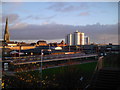
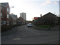
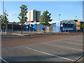
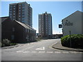
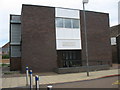
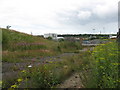
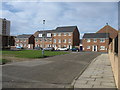
Photos of NE32 3JZ

Area Information
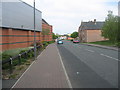
Living in NE32 3JZ means being part of a tightly knit residential cluster in northeast England, where 1,224 people reside across a densely populated area. With a population density of 1,172 people per square kilometre, this postcode reflects a compact, community-oriented environment. The area’s character is shaped by its proximity to Jarrow and surrounding towns, offering a mix of local amenities and transport links. Daily life here is influenced by the predominance of houses, with a median age of 47 and a majority of residents aged 30–64. This suggests a mature, settled population, often families or long-term residents. The area’s small size means neighbours are likely to be familiar faces, though the high crime risk score of 4 (out of 100) underscores the need for awareness. Despite this, the area’s broadband score of 96 ensures reliable internet access, supporting both work and leisure. NE32 3JZ is not a sprawling suburb but a focused community, where proximity to schools, retail, and transport hubs defines the rhythm of life.
- Area Type
- Postcode
- Area Size
- Not available
- Population
- 1224
- Population Density
- 1172 people/km²
The property market in NE32 3JZ is characterised by a 33% home ownership rate, which is below the national average, suggesting a rental market dominates. The accommodation type is primarily houses, which is unusual for a postcode with such high population density. This implies a mix of semi-detached or terraced housing, possibly catering to families or long-term residents. The low home ownership rate may indicate affordability challenges or a preference for renting in a compact area with limited new developments. For buyers, this means competition for existing homes, particularly those with garden space or larger living areas. The small size of the postcode means properties are likely to be closely spaced, with limited scope for expansion. Prospective buyers should consider the high crime risk score of 4 when evaluating the area’s safety, which could influence property value and desirability.
House Prices in NE32 3JZ
No properties found in this postcode.
Energy Efficiency in NE32 3JZ
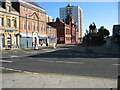
Residents of NE32 3JZ have access to a range of amenities within practical reach, from retail to transport hubs. Nearby shops include Iceland Jarrow, Morrisons Jarrow, and Morrisons Daily, offering grocery and convenience needs. The area’s proximity to Jarrow and surrounding towns means dining, leisure, and services are readily available. Transport options such as rail, metro, and ferry terminals provide flexibility for travel, while the bus stop at Rhodes Street adds local connectivity. Though the data does not specify parks or recreational areas, the absence of protected natural sites suggests open spaces may be limited. The compact nature of the area means most amenities are within walking distance, fostering a convenient, community-focused lifestyle. The mix of retail, transport, and local services ensures daily life is efficient, though residents may need to venture slightly further for specialist amenities.
Amenities
Schools
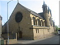
NE32 3JZ is served by a cluster of primary schools, including Dunn Street Nursery School, Dunn Street Primary School, and St Bede’s RC Primary School, Jarrow, along with its junior and infant divisions. These schools provide a full range of early years and primary education, catering to children from nursery age through to Year 6. The presence of multiple schools within the area suggests a focus on local education, reducing the need for long commutes. However, the data does not include Ofsted ratings or specific performance metrics, so prospective families should conduct further research into individual school standards. The concentration of primary schools indicates that the area is well-suited for families with young children, though secondary education options are not listed here. Parents may need to look beyond the immediate postcode for comprehensive schooling.
| Rank | School | Type | Entry gender | Ages |
|---|
Explore more schools in this area
Go to Schools tabDemographics
The community in NE32 3JZ is predominantly composed of adults aged 30–64, with a median age of 47. This suggests a population that is largely established, with fewer young families or retirees compared to other areas. Home ownership here is relatively low at 33%, indicating a higher proportion of renters than owners. The accommodation type is primarily houses, which is uncommon in densely populated areas, hinting at a mix of semi-detached or terraced properties. The predominant ethnic group is White, with no specific data on other demographics. The absence of detailed diversity statistics means the area’s cultural composition remains less defined. For quality of life, the low flood risk and lack of protected natural sites suggest minimal environmental constraints, but the high crime risk score of 4 (out of 100) raises practical concerns for residents. This score places the area above average for crime, requiring caution in safety planning.
Household Size
Accommodation Type
Tenure
Ethnic Group
Religion
Household Composition
Age
Household Deprivation
NS-SEC
Explore more demographic insights in this area
Go to Demographics tabPlanning
Planning Constraints
- Flood RiskPremium
- Ramsar Wetland SitesPremium
- Area of Outstanding Natural BeautyPremium
- Protected Nature ReservePremium
- Protected WoodlandPremium
- Crime & SafetyPremium