Area Overview for NE32 3JB
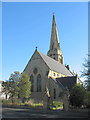
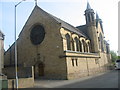
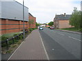
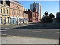
Photos of NE32 3JB


Area Information
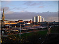
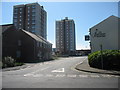
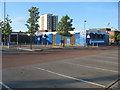
Living in NE32 3JB means being part of a tightly knit residential cluster in northeast England, where 1,599 residents live at a density of 967 people per square kilometre. This small postcode area is characterised by its compact nature, with homes clustered around local amenities and transport links. The area sits at the edge of larger towns like Jarrow and Howdon, offering a mix of suburban tranquillity and proximity to urban resources. Daily life here is shaped by a mature community, with a median age of 47 and a strong presence of adults aged 30–64. While the area is small, its strategic location near rail lines and ferry terminals ensures easy access to nearby cities and coastal towns. Residents benefit from a range of nearby retail outlets, including Iceland and Morrisons, and a well-connected transport network that links to Newcastle and South Shields. The area’s appeal lies in its balance of limited space and practical connectivity, making it a viable choice for those seeking a quieter lifestyle without sacrificing accessibility.
- Area Type
- Postcode
- Area Size
- Not available
- Population
- 1599
- Population Density
- 967 people/km²
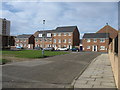
The property market in NE32 3JB is defined by a low home ownership rate of 27%, indicating that the majority of residents are likely to be renting. The area is primarily composed of houses, which suggests a focus on single-family homes rather than apartments or flats. This mix of ownership and rental properties may create a dynamic where buyers need to consider nearby areas for more options, as the immediate postcode cluster is limited in size. The presence of houses could appeal to families seeking space, though the small area means competition for properties may be high. For buyers, this small residential cluster offers a chance to own a home in a compact, well-connected location, but the limited number of properties means careful consideration of nearby neighbourhoods is essential. The market’s character is shaped by its modest scale and the balance between owner-occupied and rental housing.
House Prices in NE32 3JB
No properties found in this postcode.
Energy Efficiency in NE32 3JB
The lifestyle in NE32 3JB is supported by a range of nearby amenities, including five retail outlets such as Iceland Jarrow and Morrisons Jarrow, which cater to daily shopping needs. The area’s proximity to rail, metro, and ferry services ensures easy access to larger towns and cities, while the presence of multiple stations like Heworth and East Boldon facilitates commuting. For leisure, the nearby ferry terminals offer opportunities for coastal travel, and the rail network connects to cultural and economic hubs. The compact nature of the area means residents can reach essential services quickly, though the limited number of amenities within the postcode itself suggests that some shopping or dining may require a trip to Jarrow or Howdon. The combination of practical transport links and local retail makes daily life in NE32 3JB both convenient and connected.
Amenities
Schools
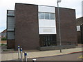
The nearest school to NE32 3JB is St Peter’s CofE Primary School, which serves the local community with primary education. No secondary schools are listed in the data, so families may need to look further afield for comprehensive schooling. The presence of a primary school suggests that the area is suitable for young children, though parents should consider the availability of secondary education in nearby towns like Jarrow or South Shields. The school’s type—Church of England—may indicate a religious affiliation, but the data does not specify its Ofsted rating. For families prioritising proximity to schools, St Peter’s provides a local option, though the lack of secondary schools in the immediate area is a factor to weigh when evaluating the area’s suitability for long-term family needs.
| Rank | School | Type | Entry gender | Ages |
|---|
Explore more schools in this area
Go to Schools tabDemographics
The community in NE32 3JB is predominantly composed of adults aged 30–64, with a median age of 47. This suggests a population that is largely in their prime working years, with fewer young families or retirees compared to other areas. Home ownership here is relatively low, with only 27% of residents owning their homes. The remaining households are likely to be renters, which may influence the local housing market and community dynamics. The predominant ethnic group is White, though specific data on diversity is not provided. The area’s demographic profile indicates a stable, middle-aged population, which may contribute to a community focused on established routines and local services. The high proportion of adults in their 30s and 40s could also suggest a workforce-oriented environment, with residents commuting to nearby towns or cities for employment.
Household Size
Accommodation Type
Tenure
Ethnic Group
Religion
Household Composition
Age
Household Deprivation
NS-SEC
Explore more demographic insights in this area
Go to Demographics tabPlanning
Planning Constraints
- Flood RiskPremium
- Ramsar Wetland SitesPremium
- Area of Outstanding Natural BeautyPremium
- Protected Nature ReservePremium
- Protected WoodlandPremium