Area Overview for NE32 3HS
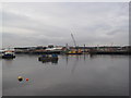
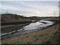
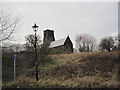
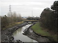
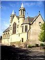
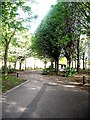
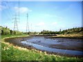
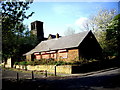
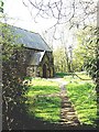
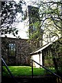
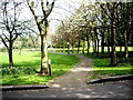
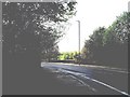
Photos of NE32 3HS
Area Information
NE32 3HS is a small residential postcode area in England, home to 1,599 people spread across a densely populated cluster. With a population density of 967 people per square kilometre, the area feels compact and community-focused. It lies in a region where practical living meets accessibility, with nearby transport links and amenities within reach. The area’s character is shaped by its demographic profile: predominantly adults aged 30–64, with a median age of 47. This suggests a stable, mature population, likely drawn to the area for its convenience and connectivity. While the postcode covers a limited physical space, its proximity to retail, transport, and educational hubs makes it a practical choice for those prioritising accessibility. The presence of schools, rail stations, and ferry terminals within practical reach adds to its appeal, though the high population density may influence the pace of daily life. For buyers, NE32 3HS offers a snapshot of suburban living with a focus on proximity to essential services, though its small size means the housing stock is tightly defined.
- Area Type
- Postcode
- Area Size
- Not available
- Population
- 1599
- Population Density
- 967 people/km²
The property market in NE32 3HS is defined by its low home ownership rate of 27%, indicating that most properties are rented rather than owned. The accommodation type is primarily houses, which suggests a lack of high-rise or apartment-style housing. This makes the area more suited to families or individuals seeking single-family homes, though the limited housing stock means options are constrained. As a small postcode area, NE32 3HS has a tightly defined market, with few properties available for purchase. Buyers should consider the implications of the low ownership rate: properties may be more likely to be available for rent, and long-term investment could be challenging. The focus on houses also means the area lacks the density of urban centres, which may appeal to those prioritising space over convenience. For those seeking a home, the market here is niche, requiring a clear understanding of the local demand and supply dynamics.
House Prices in NE32 3HS
No properties found in this postcode.
Energy Efficiency in NE32 3HS
Living in NE32 3HS offers access to a range of amenities within practical reach. The retail sector includes stores such as Morrisons Jarrow, Iceland Jarrow, and Morrisons Daily, providing essential shopping options. Transport links are robust, with rail stations, metro stops, and ferry terminals facilitating travel to nearby towns and cities. The area’s proximity to Jarrow, Bede, and Howdon metro stations enhances its connectivity, while the ferry terminals offer alternative routes. For leisure, the surrounding area likely includes parks and open spaces, though specific names are not provided in the data. The mix of retail, transport, and mobility options creates a lifestyle that balances convenience with accessibility. Residents can enjoy a blend of local shopping, efficient commuting, and regional travel, making NE32 3HS a practical choice for those valuing connectivity and proximity to services.
Amenities
Schools
The nearest school to NE32 3HS is St Peter’s CofE Primary School, a primary education institution serving the local community. No secondary schools are listed in the data, so families may need to look beyond the immediate area for comprehensive schooling. The presence of a primary school suggests the area is suitable for young families, though the absence of secondary options could be a consideration. The school’s type indicates a faith-based educational approach, which may align with the preferences of some residents. For parents, the availability of a primary school within reach is a practical advantage, but the need to travel for secondary education should be factored into long-term planning. The limited school infrastructure highlights the area’s focus on smaller-scale living, where local amenities are prioritised over expansive educational networks.
| Rank | School | Type | Entry gender | Ages |
|---|
Explore more schools in this area
Go to Schools tabDemographics
The community in NE32 3HS is predominantly composed of adults aged 30–64, with a median age of 47. This suggests a mature population, likely with established careers and families. Home ownership rates are low at 27%, indicating that most residents rent their homes. The accommodation type is primarily houses, which contrasts with areas where flats or apartments dominate. The predominant ethnic group is White, though no data is provided on other demographics. The high population density of 967 people per square kilometre means living spaces are closely packed, which can influence the character of the area. For quality of life, this density may mean limited private outdoor space but strong community interaction. The low home ownership rate also suggests a rental market, which could affect long-term stability for residents. The demographic profile reflects a settled, middle-aged population, which may influence local amenities and services.
Household Size
Accommodation Type
Tenure
Ethnic Group
Religion
Household Composition
Age
Household Deprivation
NS-SEC
Explore more demographic insights in this area
Go to Demographics tabPlanning
Planning Constraints
- Flood RiskPremium
- Ramsar Wetland SitesPremium
- Area of Outstanding Natural BeautyPremium
- Protected Nature ReservePremium
- Protected WoodlandPremium