Area Overview for NE32 3EN
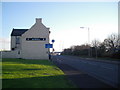
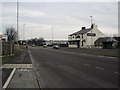
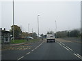
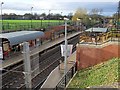
Photos of NE32 3EN


Area Information
Living in NE32 3EN means being part of a tightly knit residential cluster in England, where 1,224 people reside in a densely populated area of 1172 people per square kilometre. This small postcode area is characterised by its compact layout, offering a mix of everyday convenience and proximity to essential services. The community here is predominantly composed of adults aged 30–64, with a median age of 47, suggesting a stable, established population. Daily life is shaped by the surrounding infrastructure, including multiple retail outlets, transport links, and schools. The area’s proximity to metro stations, rail networks, and ferry terminals ensures easy access to both local amenities and regional hubs. While the housing stock is limited to individual homes, the area’s small size means residents are close to each other, fostering a sense of familiarity. However, the high population density and limited housing stock may influence property availability and competition for homes. For those seeking a quiet, functional neighbourhood with practical connectivity, NE32 3EN offers a blend of accessibility and residential simplicity.
- Area Type
- Postcode
- Area Size
- Not available
- Population
- 1224
- Population Density
- 1172 people/km²
The property market in NE32 3EN is defined by its low home ownership rate of 33%, indicating that the majority of residents rent rather than own their homes. This suggests a rental market that may be more competitive due to the area’s small size and limited housing stock. The accommodation type here is primarily houses, which is unusual for a densely populated postcode area. This mix of single-family homes in a compact setting may appeal to those seeking more private, spacious living conditions compared to flats. However, the limited availability of properties means buyers should consider the area’s small size and potential competition for homes. For those prioritising ownership, the market may be challenging, with fewer options available. The focus on houses also implies that the area is less suited to those seeking larger residential developments or investment opportunities in multi-unit properties.
House Prices in NE32 3EN
No properties found in this postcode.
Energy Efficiency in NE32 3EN
Residents of NE32 3EN enjoy a range of amenities within easy reach, including five retail outlets such as Tesco South, Asda Simonside, and Sainsburys Simonside, offering everyday shopping needs. The area’s proximity to metro stations like Bede, Simonside, and Tyne Dock, along with rail services at Brockley Whins and Heworth, provides seamless access to regional travel. Ferry terminals at Newcastle International and South Shields add to the connectivity, enabling trips across the water. The presence of multiple transport options and retail hubs suggests a practical, convenience-driven lifestyle. While the data does not specify parks or leisure facilities, the density of retail and transport services indicates a community focused on accessibility and functional living. The mix of retail, transport, and nearby schools creates a self-contained environment, though further exploration may be needed to identify recreational spaces.
Amenities
Schools
Residents of NE32 3EN have access to a range of primary and nursery schools, including Dunn Street Nursery School, Dunn Street Primary School, and St Bede’s RC Primary School, Jarrow, along with its affiliated infant and junior schools. These institutions provide early years education and primary schooling, catering to younger families in the area. The presence of multiple primary schools suggests a focus on local education, though no secondary schools are listed in the data. For families requiring secondary education, nearby areas may need to be considered. The availability of nursery and primary schools is a key factor for parents seeking to establish roots in the community, offering a structured educational environment for children from early years through to primary school. The concentration of schools in this small postcode area highlights its role as a family-friendly hub, though further research would be needed to confirm the quality of education provided.
| Rank | School | Type | Entry gender | Ages |
|---|
Explore more schools in this area
Go to Schools tabDemographics
The community in NE32 3EN is predominantly composed of adults aged 30–64, making up the most common age range, with a median age of 47. This suggests a mature, settled population, likely with established careers and family structures. Home ownership here is relatively low at 33%, indicating that a significant portion of residents rent their homes. The accommodation type is primarily houses, which is uncommon in areas with high population density, suggesting a mix of single-family dwellings in a compact setting. The predominant ethnic group is White, reflecting the area’s demographic profile. While specific data on deprivation is not provided, the low home ownership rate may indicate a reliance on rental markets, which could influence housing affordability and community stability. The age profile and housing composition suggest a community focused on long-term residency, with limited turnover of residents.
Household Size
Accommodation Type
Tenure
Ethnic Group
Religion
Household Composition
Age
Household Deprivation
NS-SEC
Explore more demographic insights in this area
Go to Demographics tabPlanning
Planning Constraints
- Flood RiskPremium
- Ramsar Wetland SitesPremium
- Area of Outstanding Natural BeautyPremium
- Protected Nature ReservePremium
- Protected WoodlandPremium