Area Overview for NE32 3DW
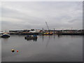
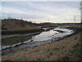
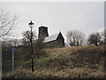
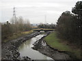
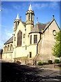
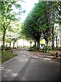
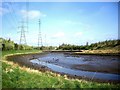
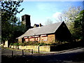
Photos of NE32 3DW

Area Information
Living in NE32 3DW means inhabiting a compact, residential cluster in England with a population of 1,599 people spread across 967 people per square kilometre. This area is characterised by its small-scale living, where the majority of residents are adults aged 30–64. The community is anchored by its housing stock, which consists primarily of houses, reflecting a quieter, more established demographic. While the area lacks the density of larger cities, its proximity to nearby towns and transport links offers a balance between rural tranquillity and urban accessibility. Residents benefit from a range of local amenities, including retail outlets, rail and ferry connections, and schools, all within practical reach. The postcode’s compact nature means that daily life is centred around immediate surroundings, with a strong emphasis on local services and community ties. However, the area’s small size also means that its appeal is niche, catering to those seeking a stable, low-density environment rather than a bustling metropolis.
- Area Type
- Postcode
- Area Size
- Not available
- Population
- 1599
- Population Density
- 967 people/km²
The property market in NE32 3DW is defined by its low home ownership rate of 27%, suggesting that the area is not a typical owner-occupied hub but rather one where rental or leasehold arrangements are more common. The accommodation type is primarily houses, which are likely to be older, traditional properties suited to families or individuals seeking space. Given the area’s small size, the housing stock is limited, and buyers must consider proximity to nearby towns for more extensive options. The low home ownership percentage may indicate a transient population or a market where properties are held by landlords. For buyers, this means competition for available homes is likely to be minimal, but the range of properties is constrained. The predominance of houses also means that those seeking flats or apartments may need to look beyond the immediate postcode. The market’s character is one of stability, with properties reflecting the area’s established, low-density appeal.
House Prices in NE32 3DW
No properties found in this postcode.
Energy Efficiency in NE32 3DW
Daily life in NE32 3DW is shaped by its proximity to a range of amenities, from retail to transport. Local shops such as Morrisons Daily, Iceland Jarrow, and Morrisons Jarrow provide grocery and household essentials, while the area’s rail and metro stations connect residents to broader networks. Ferry terminals at Newcastle International and South Shields offer access to coastal and river travel, adding to the area’s transport diversity. The presence of multiple rail stations, including Brockley Whins and Heworth, ensures regular service for commuters. The compact nature of the postcode means that amenities are within walking or short driving distance, fostering a convenient lifestyle. While the area lacks large-scale leisure facilities, its integration with nearby towns ensures that residents can access cultural, recreational, and commercial opportunities beyond the immediate postcode. This balance of local convenience and regional connectivity defines the area’s character.
Amenities
Schools
The nearest school to NE32 3DW is St Peter’s CofE Primary School, a primary institution serving the local community. While no Ofsted rating is provided, the presence of a primary school indicates that families with young children have access to foundational education within the area. The absence of secondary schools or further education institutions in the immediate vicinity suggests that students may need to travel to nearby towns for higher-level schooling. This dynamic is common in smaller postcode areas where educational infrastructure is concentrated in larger surrounding centres. For families, the availability of a primary school is a key consideration, but the lack of additional educational facilities may necessitate planning for commuting to secondary schools. The school’s role as the sole primary option underscores its importance to the local community.
| Rank | School | Type | Entry gender | Ages |
|---|
Explore more schools in this area
Go to Schools tabDemographics
The community in NE32 3DW is predominantly composed of adults aged 30–64, with a median age of 47. This suggests a mature population, likely with established careers and family ties. Home ownership is relatively low at 27%, indicating a higher proportion of renters or leaseholders compared to owner-occupied properties. The accommodation type is primarily houses, which aligns with the area’s residential character. The predominant ethnic group is White, reflecting a homogenous demographic profile. While no specific data on deprivation or diversity is provided, the low home ownership rate may suggest a mix of transient or economically mobile residents. The absence of detailed socio-economic breakdowns means the area’s quality of life is shaped by its infrastructure and services, which include schools, transport, and retail. The demographic profile indicates a stable, middle-aged population with a focus on practical living rather than high-density urban development.
Household Size
Accommodation Type
Tenure
Ethnic Group
Religion
Household Composition
Age
Household Deprivation
NS-SEC
Explore more demographic insights in this area
Go to Demographics tabPlanning
Planning Constraints
- Flood RiskPremium
- Ramsar Wetland SitesPremium
- Area of Outstanding Natural BeautyPremium
- Protected Nature ReservePremium
- Protected WoodlandPremium