Area Overview for NE32 3DH
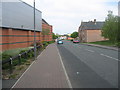
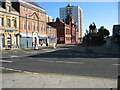
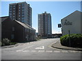
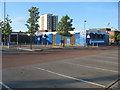
Photos of NE32 3DH


Area Information
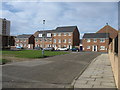
NE32 3DH is a small residential postcode area in England, home to 1,599 people spread across a densely populated cluster. With a population density of 967 people per square kilometre, this area reflects a compact, tightly knit community. Daily life here is shaped by its modest scale, where proximity to essential services and transport links plays a key role. The median age of 47 suggests a mature demographic, with the majority of residents falling within the 30–64 age range. This makes NE32 3DH a place of stability, where families and long-term residents coexist. The area’s housing stock is primarily composed of houses, though home ownership is relatively low at 27%, indicating a mix of rental properties and owner-occupied homes. While the area lacks natural or protected landscapes, its strategic location near transport hubs and retail amenities ensures practicality for daily living. For those considering a move, NE32 3DH offers a blend of accessibility and community character, though its small size means choices are limited.
- Area Type
- Postcode
- Area Size
- Not available
- Population
- 1599
- Population Density
- 967 people/km²
NE32 3DH is a small area with a limited housing stock, primarily composed of houses. Home ownership here is notably low at 27%, which suggests that the majority of properties are rented rather than owner-occupied. This dynamic may reflect a mix of long-term renters and those in transitional housing, but it also indicates that the area is not a primary destination for property buyers seeking ownership. The concentration of houses, rather than flats or apartments, points to a more traditional residential layout, though the small size of the postcode means the market is constrained. For buyers, this area may present challenges in terms of availability and competition, particularly given its proximity to transport and retail hubs. Those considering NE32 3DH should view it as part of a broader regional context, where nearby areas may offer more options.
House Prices in NE32 3DH
No properties found in this postcode.
Energy Efficiency in NE32 3DH
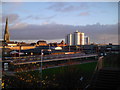
Living in NE32 3DH offers access to a range of amenities within practical reach. Retail options include Iceland Jarrow, Morrisons Jarrow, and Morrisons Daily, providing grocery and convenience shopping. Transport links are robust, with rail stations at Brockley Whins, Heworth, and East Boldon, plus metro stops at Jarrow, Howdon, and Bede. Ferry terminals at Newcastle International and South Shields offer maritime connectivity. For leisure, the area’s proximity to these services suggests a mix of practicality and accessibility. While specific parks or leisure facilities are not detailed in the data, the presence of multiple transport and retail hubs implies a lifestyle centered on convenience. Residents can easily access daily essentials, commute efficiently, and take advantage of regional transport networks, making the area suitable for those prioritising practicality over expansive recreational spaces.
Amenities
Schools
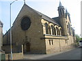
The nearest school to NE32 3DH is St Peter’s CofE Primary School, a primary education institution serving the local community. While no Ofsted rating is provided, the presence of a primary school indicates that families with young children have access to local education options. The absence of secondary schools or further education facilities within the area means residents may need to travel to nearby towns for higher-level schooling. This mix of school types suggests that the area is well-suited for families with younger children but may require planning for secondary education. The single primary school serves as a focal point for the community, though its capacity and quality would need to be assessed independently.
| Rank | School | Type | Entry gender | Ages |
|---|
Explore more schools in this area
Go to Schools tabDemographics
The population of NE32 3DH is predominantly adults aged 30–64, with a median age of 47. This suggests a community rooted in middle-aged and older residents, likely with established careers and families. Home ownership is at 27%, a figure that indicates a majority of households are renters, which may influence the local housing market’s dynamics. The primary accommodation type is houses, though the data does not specify the proportion of flats or other property types. The predominant ethnic group is White, with no specific data provided on other demographics. While the area’s low population density of 967 people per square kilometre might suggest a suburban feel, the compact nature of the postcode means residents live closely together. This demographic profile implies a community with a focus on stability, though the lack of detailed diversity data means broader social dynamics remain unexplored.
Household Size
Accommodation Type
Tenure
Ethnic Group
Religion
Household Composition
Age
Household Deprivation
NS-SEC
Explore more demographic insights in this area
Go to Demographics tabPlanning
Planning Constraints
- Flood RiskPremium
- Ramsar Wetland SitesPremium
- Area of Outstanding Natural BeautyPremium
- Protected Nature ReservePremium
- Protected WoodlandPremium