Area Overview for NE32 3DF
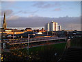
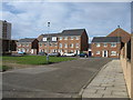
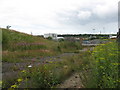
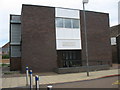
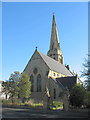
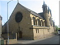
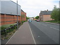
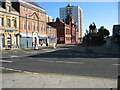
Photos of NE32 3DF


Area Information
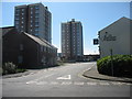
Living in NE32 3DF means being part of a tightly knit residential cluster in England, where 1,599 people reside across a compact area. The population density of 967 people per square kilometre suggests a mix of closely spaced homes and community interaction. This postcode area is characterised by its focus on single-family housing, with 27% of residents owning their homes. The median age of 47 indicates a mature population, with the majority aged between 30 and 64. Daily life here is shaped by proximity to transport hubs, including rail stations and ferry terminals, which connect residents to nearby towns and cities. While the area lacks large-scale amenities, its smaller footprint means residents can access essential services within walking or short driving distance. The high crime risk score of 3/100, however, underscores the need for caution, particularly for those prioritising safety. Despite this, the area’s compact nature and established infrastructure make it a practical choice for those seeking a quieter, more localised living environment.
- Area Type
- Postcode
- Area Size
- Not available
- Population
- 1599
- Population Density
- 967 people/km²
The property market in NE32 3DF is defined by its low home ownership rate of 27%, suggesting that the majority of housing is rented rather than owned. This makes the area more of a rental market than an owner-occupied one, which could influence buyer considerations. The accommodation type is primarily houses, which may attract those seeking larger properties but also indicates a smaller, more limited housing stock. Given the area’s compact size, the immediate surroundings are likely to offer similar property types, meaning buyers should explore beyond NE32 3DF for a broader selection. The low ownership rate could also signal affordability, but prospective buyers should weigh this against the area’s safety concerns and limited amenities. For those prioritising a single-family home in a quiet setting, the market may present opportunities, though competition could be minimal due to the small population.
House Prices in NE32 3DF
No properties found in this postcode.
Energy Efficiency in NE32 3DF
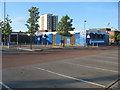
Daily life in NE32 3DF is shaped by its proximity to a range of amenities, including retail outlets like Iceland Jarrow, Morrisons Jarrow, and Morrisons Daily, which cater to grocery and household needs. The area’s metro hubs, such as Jarrow and Howdon, offer additional shopping and dining options. For transport, residents can access ferry terminals in Newcastle and South Shields, as well as five rail stations, facilitating travel to nearby regions. While the data does not specify parks or leisure facilities, the presence of multiple retail and transport points suggests a practical, service-oriented lifestyle. The compact nature of the area means that essential amenities are within walking or short driving distance, though the lack of detailed information on recreational spaces may require further exploration for those prioritising green spaces or leisure activities.
Amenities
Schools
The nearest school to NE32 3DF is St Peter’s CofE Primary School, which serves the local community with primary education. No secondary schools are listed in the data, meaning families requiring secondary education may need to look beyond the immediate area. The presence of a primary school suggests that the area is suitable for young children, though parents should consider the need for additional schooling options for older students. The absence of specific Ofsted ratings or performance data means that school quality cannot be assessed here, but the availability of a primary school adds to the area’s practical appeal for families. For those prioritising proximity to education, St Peter’s provides a foundational resource, though further research into secondary schooling would be necessary for long-term planning.
| Rank | School | Type | Entry gender | Ages |
|---|
Explore more schools in this area
Go to Schools tabDemographics
The community in NE32 3DF is predominantly composed of adults aged 30 to 64, with a median age of 47. This suggests a population that is largely settled, with fewer young families or elderly residents compared to other areas. Home ownership stands at 27%, which is notably low, indicating that a significant portion of the housing stock is rented out. The accommodation type is primarily houses, which may appeal to those seeking larger living spaces but also suggests a less dense, more suburban character. The predominant ethnic group is White, with no specific data provided on other demographics. The low home ownership rate could reflect economic factors or a preference for rental living. For quality of life, the area’s demographic profile implies a stable but not rapidly changing community, though the lack of diversity data means broader social dynamics remain unclear.
Household Size
Accommodation Type
Tenure
Ethnic Group
Religion
Household Composition
Age
Household Deprivation
NS-SEC
Explore more demographic insights in this area
Go to Demographics tabPlanning
Planning Constraints
- Flood RiskPremium
- Ramsar Wetland SitesPremium
- Area of Outstanding Natural BeautyPremium
- Protected Nature ReservePremium
- Protected WoodlandPremium
- Crime & SafetyPremium