Area Overview for NE32 3BX
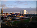
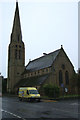
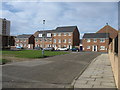
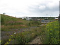
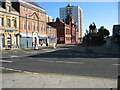
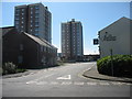
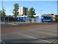
Photos of NE32 3BX

Area Information
Living in NE32 3BX means inhabiting a compact, residential postcode area in England with a population of 1,599 spread across 1,462 square metres. This small cluster of homes is densely populated, with 967 people per square kilometre, suggesting a tightly knit community. The area’s character is defined by its modest scale, where daily life is likely shaped by local interactions and proximity to amenities. While no major landmarks or cultural hubs are specified, the presence of nearby schools, transport links, and retail options indicates a functional, practical lifestyle. The median age of 47 and a predominant White population suggest a stable, mature demographic, with many residents in their prime working years. For those seeking a quiet, no-frills living environment with access to essential services, NE32 3BX offers a straightforward, low-key alternative to larger urban centres. Its small size means it is unlikely to be a destination for commuters, but it could serve as a base for those prioritising convenience over sprawling infrastructure.
- Area Type
- Postcode
- Area Size
- 1462 m²
- Population
- 1599
- Population Density
- 967 people/km²
The property market in NE32 3BX is characterised by a low home ownership rate of 27%, suggesting that the area is more rental-focused than owner-occupied. The accommodation type is predominantly houses, which may appeal to those seeking larger living spaces or a more traditional housing format. This contrasts with areas where flats or apartments dominate, and it may indicate a niche market for buyers looking for single-family homes. However, the small area size of 1,462 square metres means the housing stock is limited, potentially reducing competition for buyers. The low home ownership rate could also mean that properties are more likely to be available for purchase, though the market may be influenced by local rental demand. For those considering a purchase, the focus on houses may align with preferences for space and independence, but the area’s compact nature means that buyers should explore surrounding zones for more options.
House Prices in NE32 3BX
No properties found in this postcode.
Energy Efficiency in NE32 3BX
Residents of NE32 3BX have access to a range of amenities within practical reach, including five retail outlets such as Iceland Jarrow and Morrisons Jarrow, which cater to everyday shopping needs. The area’s transport links to Jarrow, Howdon, and Bede metro stations, along with rail services to Brockley Whins and Heworth, provide easy access to larger towns and cities. Ferry terminals at Newcastle International and South Shields offer additional mobility, particularly for commuters. While the data does not specify leisure or recreational facilities, the proximity to multiple transport hubs suggests opportunities for dining, entertainment, and cultural activities in nearby areas. The presence of a primary school and a mix of retail and transport options indicates a functional lifestyle, where convenience and practicality are prioritised over expansive amenities. Daily life in NE32 3BX is likely shaped by the balance between local resources and the need to travel for more specialised services.
Amenities
Schools
The nearest school to NE32 3BX is St Peter’s CofE Primary School, which serves young children in the area. This primary school is the only educational institution listed in the data, meaning families with older children may need to look further afield for secondary education. The presence of a primary school suggests that the area is suitable for young families, though the lack of secondary schools nearby could be a consideration for those planning for long-term schooling. The school type is a Church of England institution, which may align with specific educational or religious preferences. However, no Ofsted ratings or performance data are provided, so prospective parents would need to seek additional information on the school’s quality. For those prioritising proximity to a primary school, NE32 3BX offers a direct option, but secondary education options may require commuting.
| Rank | School | Type | Entry gender | Ages |
|---|
Explore more schools in this area
Go to Schools tabDemographics
The community in NE32 3BX is predominantly composed of adults aged 30–64, with a median age of 47. This suggests a population that is largely in their peak working years, with fewer young families or retirees compared to other areas. Home ownership is low at 27%, indicating that a majority of residents are likely to be renters, which could reflect a mix of long-term tenants and those in transient housing. The accommodation type is primarily houses, which may appeal to those seeking more space or privacy compared to flats. The predominant ethnic group is White, with no specific data on other demographics. The high population density of 967 people per square kilometre implies a compact, possibly urbanised setting where shared resources and community spaces are likely to be in demand. This profile suggests a pragmatic, working-age population with limited emphasis on family-oriented amenities, though the presence of a primary school indicates some provision for younger residents.
Household Size
Accommodation Type
Tenure
Ethnic Group
Religion
Household Composition
Age
Household Deprivation
NS-SEC
Explore more demographic insights in this area
Go to Demographics tabPlanning
Planning Constraints
- Flood RiskPremium
- Ramsar Wetland SitesPremium
- Area of Outstanding Natural BeautyPremium
- Protected Nature ReservePremium
- Protected WoodlandPremium
- Crime & SafetyPremium