Area Overview for NE31 2XJ
Photos of NE31 2XJ
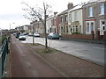
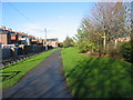
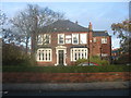
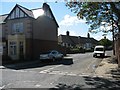
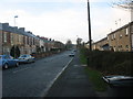
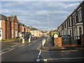
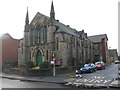
57 photos from this area
Area Information
Key information about the NE31 2XJ including its size, population, and administrative classification.
- Area Type
- Postcode
- Area Size
- 3871 m²
- Population
- 1101
- Population Density
- 7859 people/km²
House Prices in NE31 2XJ
21
Properties
£56,590
Average Sold Price
£17,500
Lowest Price
£109,950
Highest Price
Showing 21 properties
| Address | Type | Beds | Baths | Last Sale Price | Last Sale Date | |
|---|---|---|---|---|---|---|
| 34 Gladstone Street, Hebburn, NE31 2XJ | Flat | - | - | £54,000 | Jul 2024 | |
| 26 Gladstone Street, Hebburn, NE31 2XJ | Maisonette | 2 | 1 | £66,000 | Mar 2024 | |
| 13 Gladstone Street, Hebburn, NE31 2XJ | Flat | - | - | £22,500 | Feb 2024 | |
| 28 Gladstone Street, Hebburn, NE31 2XJ | Flat | - | - | £75,000 | Aug 2021 | |
| 29 Gladstone Street, Hebburn, NE31 2XJ | Terraced | 3 | - | £109,950 | Nov 2014 | |
| 17 Gladstone Street, Hebburn, NE31 2XJ | Flat | - | - | £88,450 | Jul 2008 | |
| 18 Gladstone Street, Hebburn, NE31 2XJ | Flat | 2 | 1 | £44,000 | Dec 2003 | |
| 36 Gladstone Street, Hebburn, NE31 2XJ | Flat | - | - | £61,000 | Sep 2003 | |
| 19 Gladstone Street, Hebburn, NE31 2XJ | Flat | - | - | £27,500 | Dec 1999 | |
| 20 Gladstone Street, Hebburn, NE31 2XJ | Flat | - | - | £17,500 | Sep 1999 |
Page 1 of 3
Energy Efficiency in NE31 2XJ
Amenities
Schools
| Rank | School | Type | Entry gender | Ages |
|---|
Explore more schools in this area
Go to Schools tabDemographics
Household Size
One person
most common
Accommodation Type
Houses
most common
Tenure
52
majority
Ethnic Group
White
most common
Religion
N/A
most common
Household Composition
N/A
most common
Age
47
median
Adults (30-64 years)
most common
Household Deprivation
N/A
with no deprivation
NS-SEC
23
in Lower managerial occupations
Explore more demographic insights in this area
Go to Demographics tabPlanning
Planning Constraints
- Flood RiskPremium
- Ramsar Wetland SitesPremium
- Area of Outstanding Natural BeautyPremium
- Protected Nature ReservePremium
- Protected WoodlandPremium