Area Overview for NE30 3YU
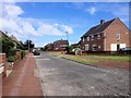
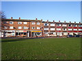
Photos of NE30 3YU


Area Information
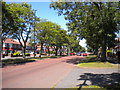
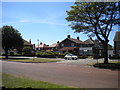
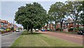
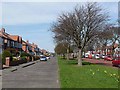
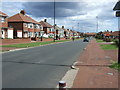
Living in NE30 3YU offers a quiet, residential lifestyle in a small cluster of homes with a population of 1753. The area is defined by its compact footprint and proximity to nearby towns, making it a practical choice for those seeking a balance between seclusion and accessibility. With a median age of 47, the community is predominantly composed of adults aged 30–64, suggesting a stable, established demographic. Most residents own their homes, with 91% of properties occupied by owners, reflecting a long-term presence. The area’s housing stock consists largely of houses, contributing to a traditional, family-friendly character. Daily life here is shaped by its location, with easy access to transport links and amenities. The low crime risk score of 95 and absence of environmental constraints like flood zones or protected areas add to its appeal. While the postcode covers a small cluster, its connections to surrounding towns and cities make it a viable option for those prioritising safety, stability, and a slower pace of life.
- Area Type
- Postcode
- Area Size
- Not available
- Population
- 1753
- Population Density
- Not available
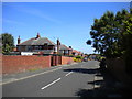
The property market in NE30 3YU is dominated by owner-occupied homes, with 91% of properties owned by residents rather than rented. This high home ownership rate suggests a community prioritising long-term residency and stability over rental investment. The accommodation type is predominantly houses, which is typical for areas with a mature demographic and a focus on family living. Given the small size of the postcode, the housing stock is likely limited in volume, meaning the market is niche and not heavily influenced by broader regional trends. Buyers should consider that the area’s compact nature means properties are unlikely to be part of a larger estate or development. The absence of rental properties indicates a lower turnover of homes, which could mean fewer opportunities for investors but a more predictable market for those seeking a permanent residence. The focus on houses also implies that the area may cater to those requiring larger living spaces rather than apartments or flats.
House Prices in NE30 3YU
No properties found in this postcode.
Energy Efficiency in NE30 3YU
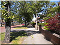
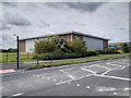
Residents of NE30 3YU have access to a range of amenities within practical reach. Retail options include Asda Tynemouth, Aldi West, and Co-op Cullercoats, providing everyday shopping convenience. The area’s proximity to metro stations like Cullercoats and Whitley Bay, along with rail services and ferry terminals at South Shields and Newcastle, ensures easy access to larger towns and cities. For commuters, the five nearby rail stations and ferry options offer multiple routes for travel. A single bus stop at Rhodes Street adds local transport flexibility. The mix of retail, transport, and connectivity options creates a practical lifestyle, allowing residents to balance local needs with broader opportunities. The presence of multiple transport links also means the area is well integrated into regional networks, supporting both daily commutes and weekend excursions.
Amenities
Schools
| Rank | School | Type | Entry gender | Ages |
|---|
Explore more schools in this area
Go to Schools tabDemographics
NE30 3YU is home to 1753 residents, with a median age of 47 and the majority (30–64 years) being adults. This suggests a mature, established community with a focus on long-term residency. Home ownership is exceptionally high at 91%, indicating a strong preference for property as an investment or lifelong home. The accommodation type is primarily houses, which aligns with the area’s residential character and likely supports larger households. The predominant ethnic group is White, though the data does not specify further diversity metrics. The absence of detailed information on household composition or deprivation levels means the community’s social dynamics remain less defined. However, the high home ownership rate and age profile suggest a stable, low-turnover environment where residents may have established careers and family ties. The area’s small size and focus on owner-occupied homes create a cohesive, tightly knit local population.
Household Size
Accommodation Type
Tenure
Ethnic Group
Religion
Household Composition
Age
Household Deprivation
NS-SEC
Explore more demographic insights in this area
Go to Demographics tabPlanning
Planning Constraints
- Flood RiskPremium
- Ramsar Wetland SitesPremium
- Area of Outstanding Natural BeautyPremium
- Protected Nature ReservePremium
- Protected WoodlandPremium
- Crime & SafetyPremium