Area Overview for NE3 4AD
Photos of NE3 4AD

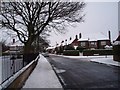
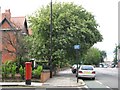
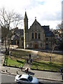
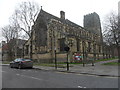

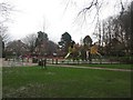
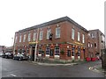
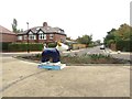


100 photos from this area
Area Information
Key information about the NE3 4AD including its size, population, and administrative classification.
- Area Type
- Postcode
- Area Size
- 4671 m²
- Population
- 1304
- Population Density
- 279140 people/km²
House Prices in NE3 4AD
19
Properties
£469,167
Average Sold Price
£190,000
Lowest Price
£700,000
Highest Price
Showing 19 properties
| Address | Type | Beds | Baths | Last Sale Price | Last Sale Date | |
|---|---|---|---|---|---|---|
| 27 High Street, Gosforth, Newcastle Upon Tyne, NE3 4AD | house | - | - | £455,000 | Feb 2025 | |
| 11 High Street, Gosforth, Newcastle Upon Tyne, NE3 4AD | Terraced | 5 | - | £700,000 | Mar 2023 | |
| 13 High Street, Gosforth, Newcastle Upon Tyne, NE3 4AD | Terraced | 5 | - | £525,000 | Aug 2020 | |
| 19 High Street, Gosforth, Newcastle Upon Tyne, NE3 4AD | Terraced | 4 | 3 | £495,000 | Dec 2019 | |
| 21 High Street, Gosforth, Newcastle Upon Tyne, NE3 4AD | house | - | - | £450,000 | Oct 2018 | |
| 29 High Street, Gosforth, Newcastle Upon Tyne, NE3 4AD | Terraced | - | - | £190,000 | Sep 1999 | |
| 15 High Street, Gosforth, Newcastle Upon Tyne, NE3 4AD | Semi-detached | 4 | - | - | - | |
| 17 High Street, Gosforth, Newcastle Upon Tyne, NE3 4AD | house | - | - | - | - | |
| 3, Moor End, High Street, Gosforth, Newcastle Upon Tyne, NE3 4AD | Flat | - | - | - | - | |
| 9, Moor End, High Street, Gosforth, Newcastle Upon Tyne, NE3 4AD | Flat | 2 | 1 | - | - |
Page 1 of 2
Energy Efficiency in NE3 4AD
Amenities
Schools
| Rank | School | Type | Entry gender | Ages |
|---|
Explore more schools in this area
Go to Schools tabDemographics
Household Size
Family (3-5 people)
most common
Accommodation Type
Houses
most common
Tenure
89
majority
Ethnic Group
White
most common
Religion
N/A
most common
Household Composition
N/A
most common
Age
47
median
Adults (30-64 years)
most common
Household Deprivation
N/A
with no deprivation
NS-SEC
64
in Lower managerial occupations
Explore more demographic insights in this area
Go to Demographics tabPlanning
Planning Constraints
- Flood RiskPremium
- Ramsar Wetland SitesPremium
- Area of Outstanding Natural BeautyPremium
- Protected Nature ReservePremium
- Protected WoodlandPremium