Area Overview for NE3 3GB
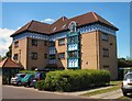
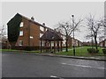
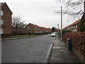
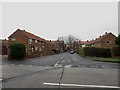
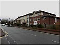
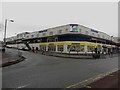
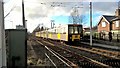
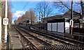
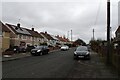
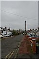
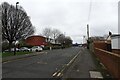
Photos of NE3 3GB

Area Information
NE3 3GB is a small residential postcode area in England, home to around 1412 people. It is a compact cluster of homes, predominantly occupied by adults aged 30-64, with a median age of 47. The area’s character is defined by its quiet, established residential nature, with houses forming the majority of accommodation types. Daily life here is shaped by proximity to essential services and transport links. Residents benefit from being near multiple rail stations, including Manors and Metrocentre, and within reach of Newcastle Airport. The area’s small size means it is likely to feel close-knit, though the population is not large enough to create a bustling urban vibe. For those seeking a balance between convenience and tranquility, NE3 3GB offers access to nearby retail outlets, public transport, and a moderate level of digital connectivity. Its appeal lies in its practicality—homes are available, and the area is well-served by infrastructure, though it lacks the density of larger towns.
- Area Type
- Postcode
- Area Size
- Not available
- Population
- 1412
- Population Density
- Not available
NE3 3GB is a small area with a limited number of homes, predominantly houses. Home ownership accounts for 48% of properties, meaning nearly half are rented, though the exact balance between private and social housing is unclear. The focus on houses suggests a market suited to families or individuals seeking more space, rather than high-density living. Given the area’s size, the housing stock is unlikely to be vast, which could make it a competitive market for buyers. The moderate home ownership rate indicates a mix of long-term residents and renters, but the lack of specific data on property prices or availability means buyers must consider the area’s small footprint and limited scope for expansion. For those prioritising space and a quieter lifestyle, NE3 3GB may offer value, but its compact nature means proximity to amenities and transport is critical.
House Prices in NE3 3GB
No properties found in this postcode.
Energy Efficiency in NE3 3GB
Living in NE3 3GB offers access to a range of local amenities within practical reach. Retail options include shops like Heron Kenton, Spar, and Aldi Kenton, providing everyday essentials. The area is served by five metro stations, including Fawdon and Wansbeck Road, which connect to broader transport networks. Rail services are plentiful, with stations such as Manors and Metrocentre Railway Station offering links to Newcastle and beyond. Proximity to Newcastle Airport adds convenience for travel. While the area lacks large parks or leisure facilities, its compact nature ensures that services are close to homes. The presence of multiple transport hubs and retail options supports a lifestyle that balances convenience with a quieter, residential environment.
Amenities
Schools
| Rank | School | Type | Entry gender | Ages |
|---|
Explore more schools in this area
Go to Schools tabDemographics
The population of NE3 3GB is predominantly adults aged 30-64, with a median age of 47. This suggests a mature, stable community, likely with established families and professionals. Home ownership rates stand at 48%, indicating a mix of owner-occupied properties and rental stock, though not overwhelmingly skewed toward either. The area is primarily composed of houses, reflecting a preference for single-family living. The predominant ethnic group is White, with no data provided on other demographic groups. While no specific deprivation data is available, the age profile and home ownership figures suggest a community with moderate economic stability. The absence of younger residents or higher rental rates implies a relatively static population, with limited turnover in housing. This could mean a consistent, long-term presence of residents, though it may also limit the diversity of local experiences.
Household Size
Accommodation Type
Tenure
Ethnic Group
Religion
Household Composition
Age
Household Deprivation
NS-SEC
Explore more demographic insights in this area
Go to Demographics tabPlanning
Planning Constraints
- Flood RiskPremium
- Ramsar Wetland SitesPremium
- Area of Outstanding Natural BeautyPremium
- Protected Nature ReservePremium
- Protected WoodlandPremium