Area Overview for NE3 3DL
Photos of NE3 3DL
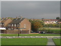
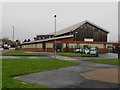
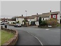
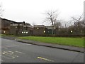
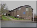
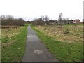
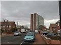
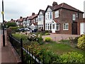
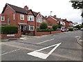
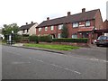
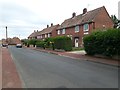
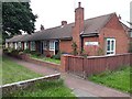
34 photos from this area
Area Information
Key information about the NE3 3DL including its size, population, and administrative classification.
- Area Type
- Postcode
- Area Size
- 8575 m²
- Population
- 1500
- Population Density
- 5853 people/km²
House Prices in NE3 3DL
25
Properties
£233,675
Average Sold Price
£59,950
Lowest Price
£362,000
Highest Price
Showing 25 properties
| Address | Type | Beds | Baths | Last Sale Price | Last Sale Date | |
|---|---|---|---|---|---|---|
| 19 Braintree Gardens, Kenton, Newcastle Upon Tyne, NE3 3DL | Semi-detached | 3 | 1 | £304,000 | Mar 2025 | |
| 10 Braintree Gardens, Kenton, Newcastle Upon Tyne, NE3 3DL | Semi-detached | 4 | 2 | £325,000 | Dec 2024 | |
| 2 Braintree Gardens, Kenton, Newcastle Upon Tyne, NE3 3DL | Semi-detached | 5 | 1 | £362,000 | Jan 2024 | |
| 25 Braintree Gardens, Kenton, Newcastle Upon Tyne, NE3 3DL | Semi-detached | 3 | - | £260,000 | Aug 2021 | |
| 17 Braintree Gardens, Kenton, Newcastle Upon Tyne, NE3 3DL | Semi-detached | 3 | 1 | £340,000 | Jun 2021 | |
| 23 Braintree Gardens, Kenton, Newcastle Upon Tyne, NE3 3DL | house | - | - | £295,500 | Aug 2020 | |
| 11 Braintree Gardens, Kenton, Newcastle Upon Tyne, NE3 3DL | house | 3 | - | £200,000 | Oct 2018 | |
| 22 Braintree Gardens, Kenton, Newcastle Upon Tyne, NE3 3DL | Semi-detached | 3 | - | £237,500 | Aug 2017 | |
| 4 Braintree Gardens, Kenton, Newcastle Upon Tyne, NE3 3DL | house | - | - | £300,000 | Jul 2016 | |
| 21 Braintree Gardens, Kenton, Newcastle Upon Tyne, NE3 3DL | Semi-detached | 3 | 1 | £240,000 | Apr 2015 |
Page 1 of 3
Energy Efficiency in NE3 3DL
Amenities
Schools
| Rank | School | Type | Entry gender | Ages |
|---|
Explore more schools in this area
Go to Schools tabDemographics
Household Size
Family (3-5 people)
most common
Accommodation Type
Houses
most common
Tenure
74
majority
Ethnic Group
White
most common
Religion
N/A
most common
Household Composition
N/A
most common
Age
47
median
Adults (30-64 years)
most common
Household Deprivation
N/A
with no deprivation
NS-SEC
42
in Lower managerial occupations
Explore more demographic insights in this area
Go to Demographics tabPlanning
Planning Constraints
- Flood RiskPremium
- Ramsar Wetland SitesPremium
- Area of Outstanding Natural BeautyPremium
- Protected Nature ReservePremium
- Protected WoodlandPremium