Area Overview for NE3 1XW
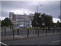
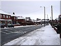
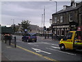
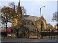
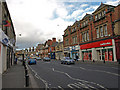
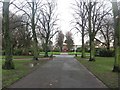
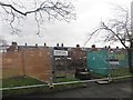
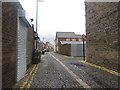
Photos of NE3 1XW
Area Information
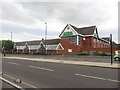
NE3 1XW is a small, tightly knit residential cluster in England, covering just 5.3 hectares and home to 1,393 residents. Its high population density—26,433 people per square kilometre—reflects a compact, community-focused layout. This area is defined by its proximity to essential services, with five railway stations, multiple retail outlets, and easy access to Newcastle Airport within practical reach. Daily life here is shaped by a balance of urban convenience and residential tranquility. The area’s compact size means amenities are within walking or short transit distance, fostering a sense of accessibility. With a median age of 47 and a population skewed toward adults aged 30–64, the community is stable and family-oriented. Home ownership is high at 79%, with most properties being houses, suggesting a long-term, settled demographic. Living in NE3 1XW offers a blend of practicality and proximity to transport hubs, making it appealing for commuters and those prioritising connectivity.
- Area Type
- Postcode
- Area Size
- 5.3 hectares
- Population
- 1393
- Population Density
- 26433 people/km²
NE3 1XW is predominantly an owner-occupied area, with 79% of homes owned by residents rather than rented. The accommodation type is primarily houses, which is unusual for a small postcode area but suggests a focus on family homes and long-term residency. This mix of high home ownership and house-based housing stock indicates a market where properties are likely to hold value, particularly for those seeking stable, settled living. The compact size of the area means the housing stock is limited, so buyers should consider nearby regions for more options. The presence of multiple railway stations and retail hubs within proximity adds to the area’s appeal, making it attractive for commuters or those requiring easy access to services. For buyers, the combination of home ownership rates and property types suggests a market that prioritises security and permanence over rental flexibility.
House Prices in NE3 1XW
Showing 1 properties
| Address | Type | Beds | Baths | Last Sale Price | Last Sale Date | |
|---|---|---|---|---|---|---|
| Nexus, Metro Offices, Gosforth Industrial Estate, Christon Road, Gosforth, Newcastle Upon Tyne, NE3 1XW | general_industrial | - | - | - | - |
Energy Efficiency in NE3 1XW
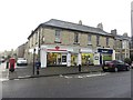
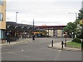
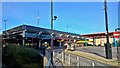
Living in NE3 1XW offers a range of amenities within easy reach. The area is served by five metro stops, including South Gosforth and Regent Centre, providing access to public transport and urban hubs. Retail options are plentiful, with M&S Gosforth, Asda Gosforth, and Sainsburys Newcastle Haddricks offering shopping convenience. Rail connectivity is strong, with five stations nearby, including Manors Railway Station and Metrocentre Railway Station, making commuting straightforward. The proximity to Newcastle Airport adds to the area’s accessibility. For leisure, the Ilford Road and Rhodes Street bus routes provide additional transport options. The mix of retail, transport, and proximity to larger urban centres creates a lifestyle that balances local convenience with broader opportunities, ideal for those seeking both independence and connectivity.
Amenities
Schools
The nearest school to NE3 1XW is Gosforth Central Middle School, a primary school with an Ofsted rating of ‘good’. This indicates a reliable educational option for younger children, though families requiring secondary schooling may need to look further afield. The presence of a primary school with a positive rating suggests the area is suitable for families with young children, offering a foundation for early education. However, the data does not specify secondary schools in the immediate vicinity, so prospective buyers with older children should investigate nearby options. The school’s rating reflects a standard of teaching and facilities that meet regulatory benchmarks, contributing to the area’s appeal for households prioritising education quality.
| Rank | School | Type | Entry gender | Ages |
|---|
Explore more schools in this area
Go to Schools tabDemographics
The population of NE3 1XW skews heavily toward adults aged 30–64, with a median age of 47. This suggests a mature, established community with a strong presence of families and professionals. Home ownership is high at 79%, indicating a stable housing market and long-term residency. The predominant accommodation type is houses, which aligns with the area’s residential character. The majority of residents identify as White, reflecting the broader demographic patterns of the region. While specific data on deprivation is not provided, the high home ownership rate and proximity to amenities suggest a relatively affluent or stable community. The absence of significant demographic diversity means the area’s cultural and social landscape is largely homogenous. For buyers, this profile indicates a neighbourhood with a focus on continuity, where property values and community dynamics are likely to remain consistent over time.
Household Size
Accommodation Type
Tenure
Ethnic Group
Religion
Household Composition
Age
Household Deprivation
NS-SEC
Explore more demographic insights in this area
Go to Demographics tabPlanning
Planning Constraints
- Flood RiskPremium
- Ramsar Wetland SitesPremium
- Area of Outstanding Natural BeautyPremium
- Protected Nature ReservePremium
- Protected WoodlandPremium