Area Overview for NE3 1LE
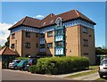
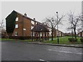
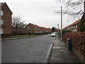
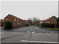
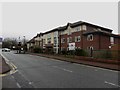
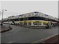
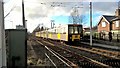
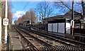
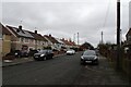
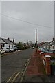
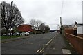
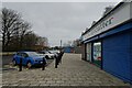
Photos of NE3 1LE
Area Information
NE3 1LE is a small residential postcode area in England, home to around 1330 residents. It is a compact cluster of properties, predominantly houses, situated in a setting that balances suburban comfort with proximity to key infrastructure. The area’s population reflects a mature demographic, with a median age of 47 and the majority of residents falling within the 30-64 age range. This suggests a community of established homeowners and families, many of whom may have lived in the area for years. Daily life here is shaped by its accessibility to transport networks, including multiple metro and rail stations, and its proximity to retail hubs like Aldi Kenton and Asda Gosforth. While the area is small, it offers a mix of practical amenities and connectivity, making it suitable for those seeking a settled lifestyle without sacrificing convenience. The low flood risk and absence of environmental constraints further enhance its appeal, though the moderate crime risk means residents should remain mindful of standard security measures.
- Area Type
- Postcode
- Area Size
- Not available
- Population
- 1330
- Population Density
- 4777 people/km²
The property market in NE3 1LE is defined by a 46% home ownership rate, with houses being the primary type of accommodation. This indicates a community where many residents own their homes, though nearly half of properties are likely rented. The focus on houses rather than flats suggests a preference for standalone properties, which may appeal to families or those seeking more space. Given the area’s small size, the housing stock is limited, which could mean competition for available properties. Buyers should consider that the market may not cater to those seeking high-density living. The mix of owner-occupied and rental properties also implies a degree of flexibility for new buyers, though the specific types of homes available would depend on the immediate surroundings.
House Prices in NE3 1LE
No properties found in this postcode.
Energy Efficiency in NE3 1LE
The lifestyle in NE3 1LE is supported by a range of nearby amenities, including five metro stations such as Fawdon and Wansbeck Road, and rail services like Metrocentre Railway Station. Retail options include Aldi Kenton and Asda Gosforth, providing everyday shopping convenience. The area’s proximity to Newcastle Airport and multiple bus routes adds to its accessibility. While there are no specific parks or leisure facilities listed, the density of transport and retail options suggests a practical, commuter-friendly environment. The mix of metro, rail, and retail amenities ensures residents can meet daily needs without long journeys, though those seeking more green spaces may need to look beyond the immediate area.
Amenities
Schools
The nearest school to NE3 1LE is Regent Farm First School, a primary school with a good Ofsted rating. This provides a reliable option for families with young children, though the area lacks secondary schools. The presence of a well-rated primary school is a key consideration for parents prioritising early education. However, families requiring secondary schooling would need to look beyond the immediate vicinity. The single school listed highlights the importance of planning for long-term educational needs, particularly for growing families. The absence of additional schools may influence decisions about proximity to other amenities or transport links.
| Rank | School | Type | Entry gender | Ages |
|---|
Explore more schools in this area
Go to Schools tabDemographics
The community in NE3 1LE is predominantly composed of adults aged 30-64, with a median age of 47. This suggests a population of middle-aged individuals, many of whom may be in their peak working years or nearing retirement. Home ownership stands at 46%, indicating a mix of owner-occupied properties and rental homes. The area is characterised by houses rather than flats, reflecting a traditional housing stock. The predominant ethnic group is White, which aligns with broader trends in the region. While specific data on deprivation is not provided, the age profile and home ownership rate suggest a relatively stable community. The absence of significant demographic diversity may appeal to those seeking a familiar social environment, though it also means the area’s cultural and social dynamics are less varied.
Household Size
Accommodation Type
Tenure
Ethnic Group
Religion
Household Composition
Age
Household Deprivation
NS-SEC
Explore more demographic insights in this area
Go to Demographics tabPlanning
Planning Constraints
- Flood RiskPremium
- Ramsar Wetland SitesPremium
- Area of Outstanding Natural BeautyPremium
- Protected Nature ReservePremium
- Protected WoodlandPremium