Area Overview for NE29 9BZ
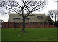
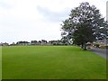
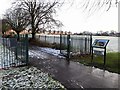
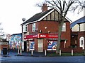
Photos of NE29 9BZ
Area Information
Living in NE29 9BZ means inhabiting a compact, densely populated residential cluster in north-east England. With an area of 6,394 square metres and a population of 1,440, this postcode is a microcosm of suburban life. The high population density of 225,206 people per square kilometre reflects a tightly knit community, where daily life is shaped by proximity to local amenities and transport links. This area is not defined by sprawling estates but by a mix of homes and practical infrastructure. Its location offers access to nearby towns and coastal routes, though it retains a quiet, residential character. For those seeking a balance between urban convenience and a sense of community, NE29 9BZ provides a compact, well-served environment. The presence of schools, retail outlets, and transport hubs within walking or short driving distance suggests a lifestyle focused on accessibility and ease of movement. While the area’s size limits expansion, its density ensures that essential services are close at hand, making it appealing to those prioritising convenience over space.
- Area Type
- Postcode
- Area Size
- 6394 m²
- Population
- 1440
- Population Density
- 225206 people/km²
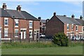
NE29 9BZ is largely an owner-occupied area, with 90% of homes owned by residents rather than rented out. The accommodation type is predominantly houses, which suggests a focus on family homes rather than apartments or flats. This makes the area appealing to those seeking a traditional, spacious living environment, though the small size of the postcode means the housing stock is limited. The high home ownership rate indicates a stable market with little turnover, which could mean fewer opportunities for buyers but also less competition. For those considering the area, the dominance of houses may appeal to buyers prioritising space and privacy. However, the compact size of NE29 9BZ means the immediate surroundings, rather than the area itself, are more likely to offer a broader range of property types. Buyers should consider the broader regional context when evaluating the local property market.
House Prices in NE29 9BZ
No properties found in this postcode.
Energy Efficiency in NE29 9BZ
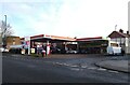
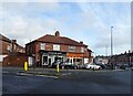
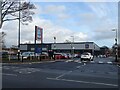
The lifestyle in NE29 9BZ is shaped by its proximity to a range of amenities. Local retail options include Co-op North Shields, Aldi Hawkeys, and Tesco North Shields Beach, providing access to groceries and everyday essentials. The area’s transport links, including rail, bus, ferry, and metro services, ensure residents can travel easily to nearby towns and cities. For leisure, the presence of ferry terminals and metro stations suggests opportunities for coastal excursions or urban exploration. The compact nature of the area means amenities are clustered closely, reducing the need for long journeys. While there is no mention of parks or recreational spaces in the data, the variety of transport and retail options indicates a practical, convenience-focused lifestyle. The mix of local shops and regional connectivity allows residents to balance daily needs with broader opportunities, making the area suitable for those who value accessibility over expansive open spaces.
Amenities
Schools
Residents of NE29 9BZ have access to Whitehouse Primary School, a primary school serving younger children, and Tynemouth College, a sixth-form institution for older students. The presence of both primary and post-16 education options suggests a range of educational pathways for families. Whitehouse Primary School, listed twice in the data, may indicate its significance as a local hub for younger pupils. However, no Ofsted ratings or additional details about the schools are provided. For families, the availability of a primary school within the area and a sixth-form college nearby offers convenience, reducing the need for long commutes. The absence of secondary schools in the immediate vicinity may require students to travel to nearby towns for secondary education, though the proximity to Tynemouth College could mitigate this.
| Rank | School | Type | Entry gender | Ages |
|---|
Explore more schools in this area
Go to Schools tabDemographics
NE29 9BZ is predominantly inhabited by adults aged 30–64, with a median age of 47. This suggests a mature, stable population, likely with established careers and families. The high home ownership rate of 90% indicates a community of long-term residents, many of whom may have lived in the area for decades. The accommodation type is primarily houses, which aligns with the demographic profile of older, family-oriented households. The predominant ethnic group is White, reflecting a lack of diversity in the local population. While no data on deprivation or income levels is provided, the high home ownership and age profile suggest a relatively affluent or stable community. The absence of younger demographics or rental properties implies limited turnover, which could affect the social dynamics of the area. For buyers, this demographic profile may indicate a low-risk, predictable environment with minimal pressure from transient populations.
Household Size
Accommodation Type
Tenure
Ethnic Group
Religion
Household Composition
Age
Household Deprivation
NS-SEC
Explore more demographic insights in this area
Go to Demographics tabPlanning
Planning Constraints
- Flood RiskPremium
- Ramsar Wetland SitesPremium
- Area of Outstanding Natural BeautyPremium
- Protected Nature ReservePremium
- Protected WoodlandPremium
- Crime & SafetyPremium