Area Overview for NE29 7UU
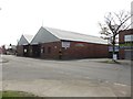
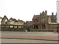
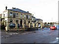
Photos of NE29 7UU


Area Information
NE29 7UU is a small, tightly packed residential postcode area in England, home to 1431 people spread across a compact footprint. With a population density of 1030 people per square kilometre, this is a community where proximity to neighbours is a given. The area is characterised by its mature demographic, with a median age of 47 and a majority of residents aged between 30 and 64. This suggests a stable, established population, likely with strong local ties. Daily life here is shaped by the mix of housing types, with homes predominating over other accommodation forms. The area’s small size means residents are likely to find local amenities and services within walking or short driving distance, though its character is defined as much by its quiet, residential nature as by its practical connectivity to nearby towns and transport hubs. For buyers, NE29 7UU offers a snapshot of a community that balances privacy with accessibility, though its limited scale means it is best considered as part of a broader regional context.
- Area Type
- Postcode
- Area Size
- Not available
- Population
- 1431
- Population Density
- 1030 people/km²
The property market in NE29 7UU is defined by its 52% home ownership rate and the prevalence of houses as the primary accommodation type. This suggests a community where owner-occupation is common, though not universal, and where properties are likely to be family homes rather than smaller units. The small size of the area means the housing stock is limited, and buyers may need to consider nearby postcode areas for a broader selection. The focus on houses implies that the market is more suited to those seeking space and stability, rather than investors or renters looking for smaller properties. Given the area’s compact nature, property values may be influenced by proximity to transport links and local amenities, making location a key factor for buyers.
House Prices in NE29 7UU
No properties found in this postcode.
Energy Efficiency in NE29 7UU
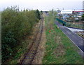
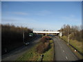
The lifestyle in NE29 7UU is shaped by its proximity to a range of amenities. Residents have access to five retail outlets, including Spar, Aldi Howdon, and Tesco North, ensuring everyday shopping needs are met. The area’s transport network includes five metro stops, five railway stations, and two ferry terminals, facilitating travel to nearby towns and cities. For leisure, the nearby ferry terminals at Newcastle and South Shields offer access to coastal and urban attractions, while rail stations provide links to broader regional hubs. The presence of bus services, such as the Rhodes Street route, adds to the area’s connectivity. Though the data does not specify parks or recreational facilities, the mix of retail, transport, and commuter links suggests a practical, functional lifestyle focused on accessibility and convenience.
Amenities
Schools
Residents of NE29 7UU have access to two primary schools, both rated as good by Ofsted. Collingwood Primary School and Norham High School serve the area, providing a foundation for early education. The presence of two primary schools suggests that families with young children have options for schooling, though the data does not indicate the availability of secondary education in the immediate vicinity. The good Ofsted ratings reflect standards that meet or exceed national benchmarks, which is a positive indicator for parents seeking quality education. However, the absence of secondary schools in the area may require families to consider commuting to nearby towns for higher education, which could impact the overall convenience of living in NE29 7UU.
| Rank | School | Type | Entry gender | Ages |
|---|
Explore more schools in this area
Go to Schools tabDemographics
The population of NE29 7UU is predominantly adults aged 30 to 64, with a median age of 47. This suggests a community of middle-aged residents, many of whom may be in their peak earning years or nearing retirement. Home ownership in the area stands at 52%, indicating a mix of owner-occupied and rented properties. The accommodation type is primarily houses, which aligns with the demographic profile of families or individuals seeking more space than flats. The predominant ethnic group is White, reflecting a homogenous population. While specific data on deprivation is not provided, the high proportion of homeowners and the age range suggest a relatively stable economic profile. However, the absence of detailed socio-economic indicators means that assumptions about quality of life should be tempered by the lack of further context.
Household Size
Accommodation Type
Tenure
Ethnic Group
Religion
Household Composition
Age
Household Deprivation
NS-SEC
Explore more demographic insights in this area
Go to Demographics tabPlanning
Planning Constraints
- Flood RiskPremium
- Ramsar Wetland SitesPremium
- Area of Outstanding Natural BeautyPremium
- Protected Nature ReservePremium
- Protected WoodlandPremium